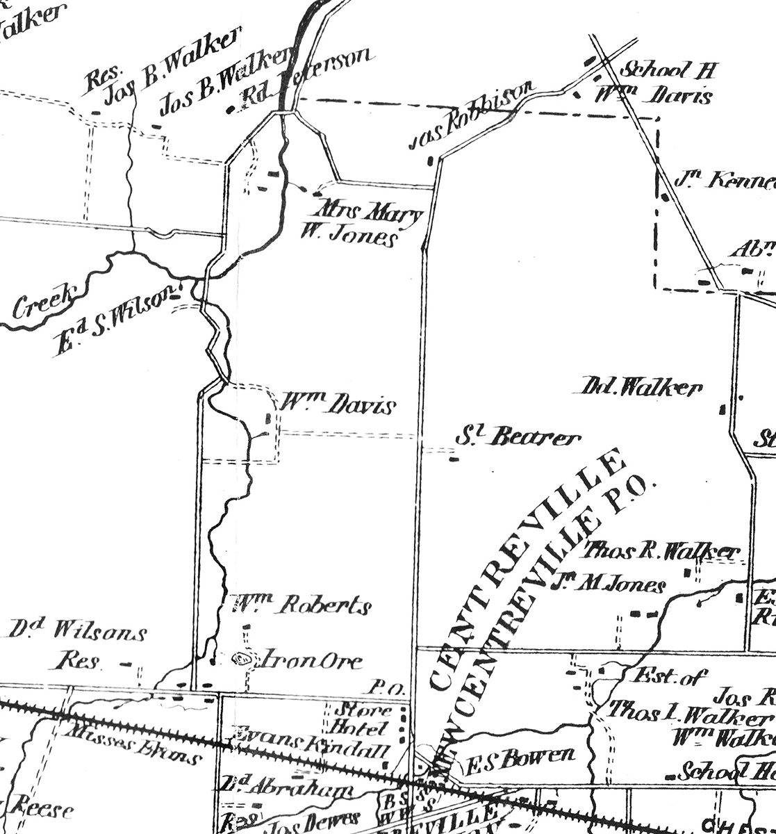
William DavisThe parentage of William Davis is unclear. There were many branches of the Davis family in Chester County in the 18th century. There are at least two William Davises from Chester County in the Revolutionary War military records. His time and knowledge of the Valley Forge encampment originates in his enlistment as a drummer boy in the Continental Army (see Three Pre-Revolutionary War Houses with a Family Connection by Nancy Pusey). In 1789 he married Mary Havard, the only child of John Havard junior. It is not clear where he was living prior to the marriage or how he met Mary Havard. They had 7 or 8 children. Their initials are on the Federal Barn at Duportail’s Quarters together with the construction date of 1792. In 1796 he purchased a farm of 50 acres that straddled Tredyffrin and Upper Merion and was in what is now Valley Forge National Historical Park. Later purchases expanded the size of this farm, which was located in the area between the Memorial Arch and Wayne’s Woods. John Havard died in 1797 His will seems to be contradictory as he gives the Duportail estate to his grandson John Havard Davis when he reaches the age of 21, but also to his daughter in her lifetime. The result seems to be that the estate is listed in William Davis’ name (as Mary’s husband). John Havard Davis got into financial difficulties in 1819 and then died in 1821 at a young age (see Three Pre-Revolutionary War Houses with a Family Connection by Nancy Pusey). In 1799 William was appointed a Justice of the Peace. He died intestate in 1848 and his properties were inherited by his children. After a number of their deaths it was solely inherited by William Davis junior. The farms can be seen in the following extract from Wilmer’s Atlas of 1873. | ||
 | ||
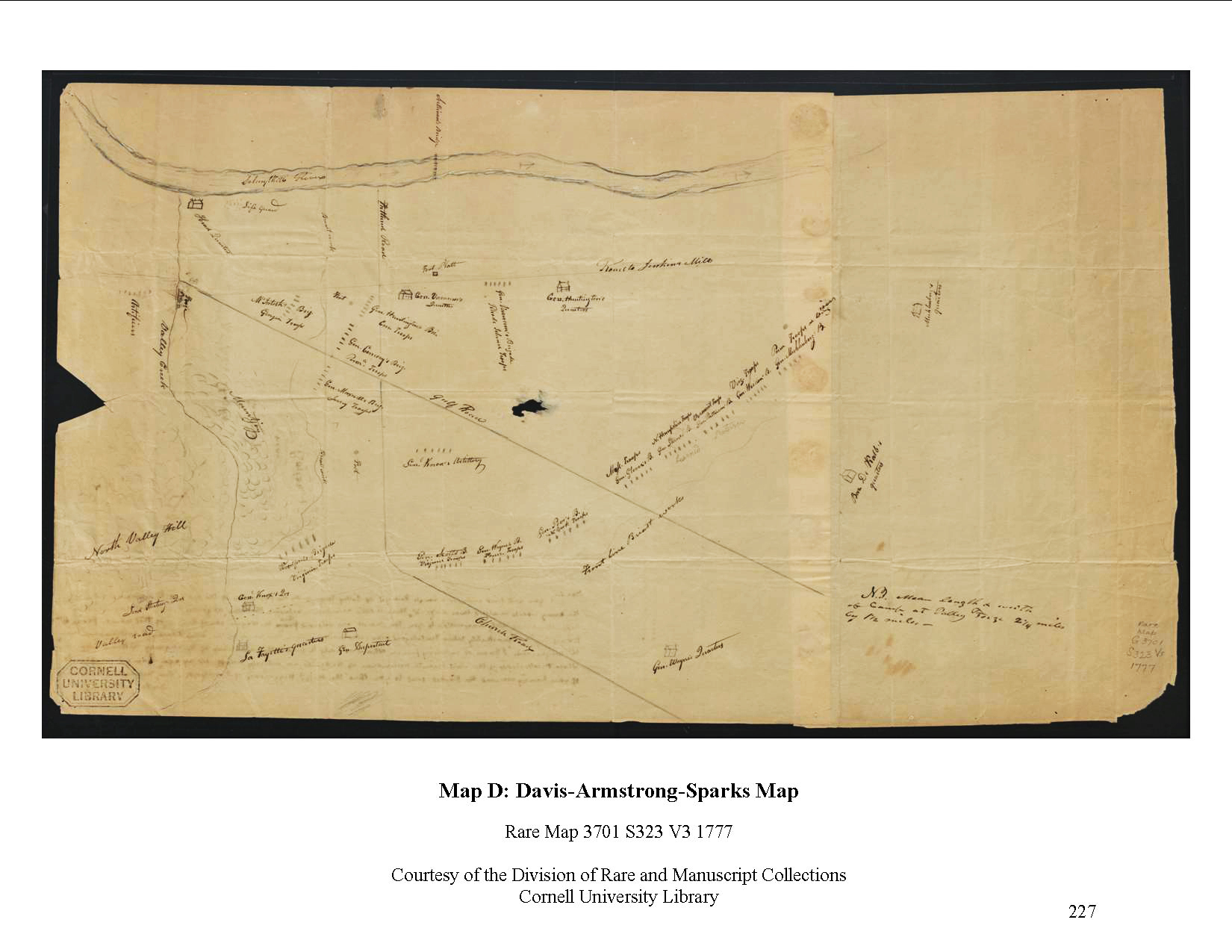
The MapThis map drawn by William Davis in 1833 (or perhaps a little earlier) is the earliest map showing the location of the General’s Quarters at the Revolutionary War encampment at Valley Forge. It shows the quarters of ten of the Generals: Washington, Stirling, Knox, LaFayette, Duportail, Wayne, DeKalb, Muhlenberg, Huntingdon and Varnum. The position of the various Brigades is also shown. The encampment map was passed to a son of Anthony Wayne and then to General John Armstrong, a Militia General in the Revolutionary War. After the war Armstrong became a politician and was a Senator for New York and Secretary for War (1813 – 1814). He also had a strong interest in history. Armstrong gave the map to Jared Sparks, Professor of History and later President of Havard University. He wrote a note to Sparks on the back of the map that reads: Dear Sir,
You will find enclosed a rough draught of Valley Forge, with the positions of the different Brigades comprising the army which wintered there in 77 – 8. There is little accordance between the latter [3 undecipherable words] & that furnished by Capt. Markland lately transmitted to you. The present was obtained thro’ M. Wayne, son of the Gen. of that name – from William Davis Esq. a remarkably active & intelligent man – who resided within the limits of the Camp during its continuance. There Mr. Wayne adds “I know of no living person who is so likely to fulfill the intentions of the enquiry, as this gentleman.” Whose recollection of the most minute occurrences of the period, are entirely unaffected by age. I am yet unapprised of your having received the packet sent to you thro’ the Messrs. Higgenson of New York. Very respectfully & sincerely, yours J. Armstrong
The Sparks map collection was acquired by Cornell University in 1872. | ||
| ||
The map is not very readable with bleed-through from the back in the lower left-hand corner. An Annotated version of the Map opens in a new window. Warning: this image is 4 Mb in size. | ||