 | ||||||||||||||||||||||||||||||||||||||||||||||||||||||||||||||||||||||||||||||||||||||||||||||||||||||||||||||||||||||||||||||||||||||||||||||||||||||||||||||||||||||||||||||||||||||||||||||||||||||||||||||||||||||||||||||||||||||||||||||||||||||||||||||||||||||||||||||||||||||||||||||||||||||||||||||||||||||||||||||||||||
|
Charlestown Deed History Home :
Use the links at the left to return.
|
||||||||||||||||||||||||||||||||||||||||||||||||||||||||||||||||||||||||||||||||||||||||||||||||||||||||||||||||||||||||||||||||||||||||||||||||||||||||||||||||||||||||||||||||||||||||||||||||||||||||||||||||||||||||||||||||||||||||||||||||||||||||||||||||||||||||||||||||||||||||||||||||||||||||||||||||||||||||||||||||||||
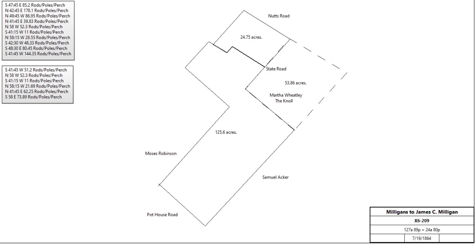
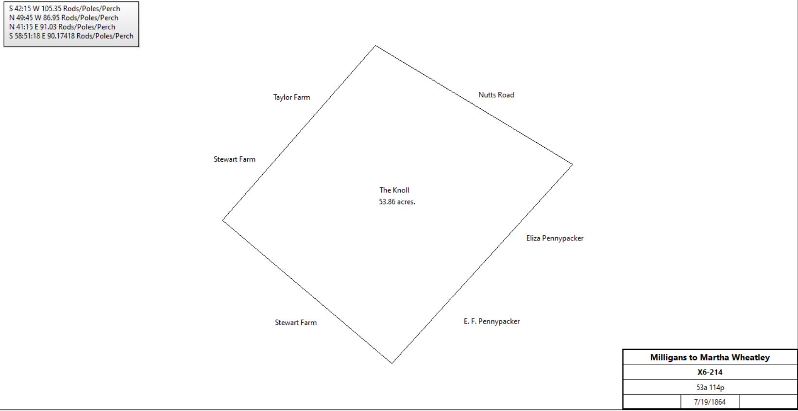
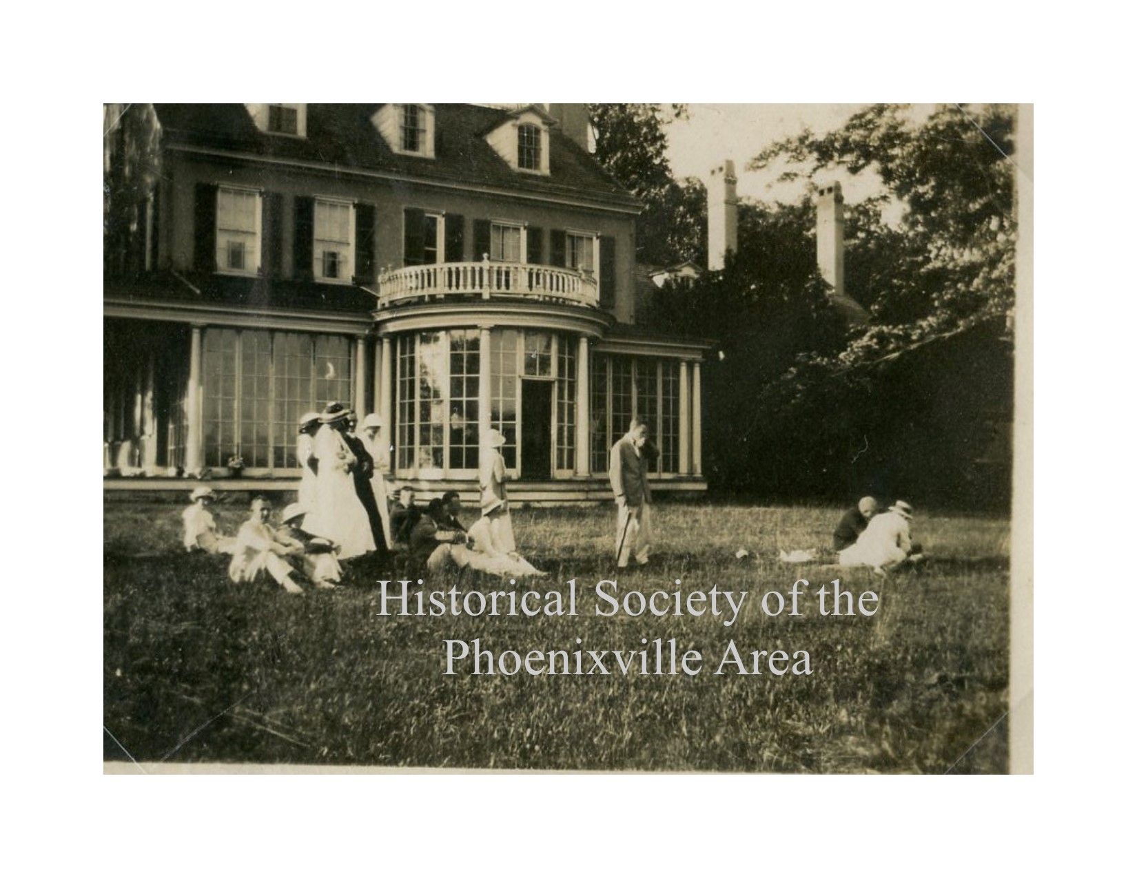
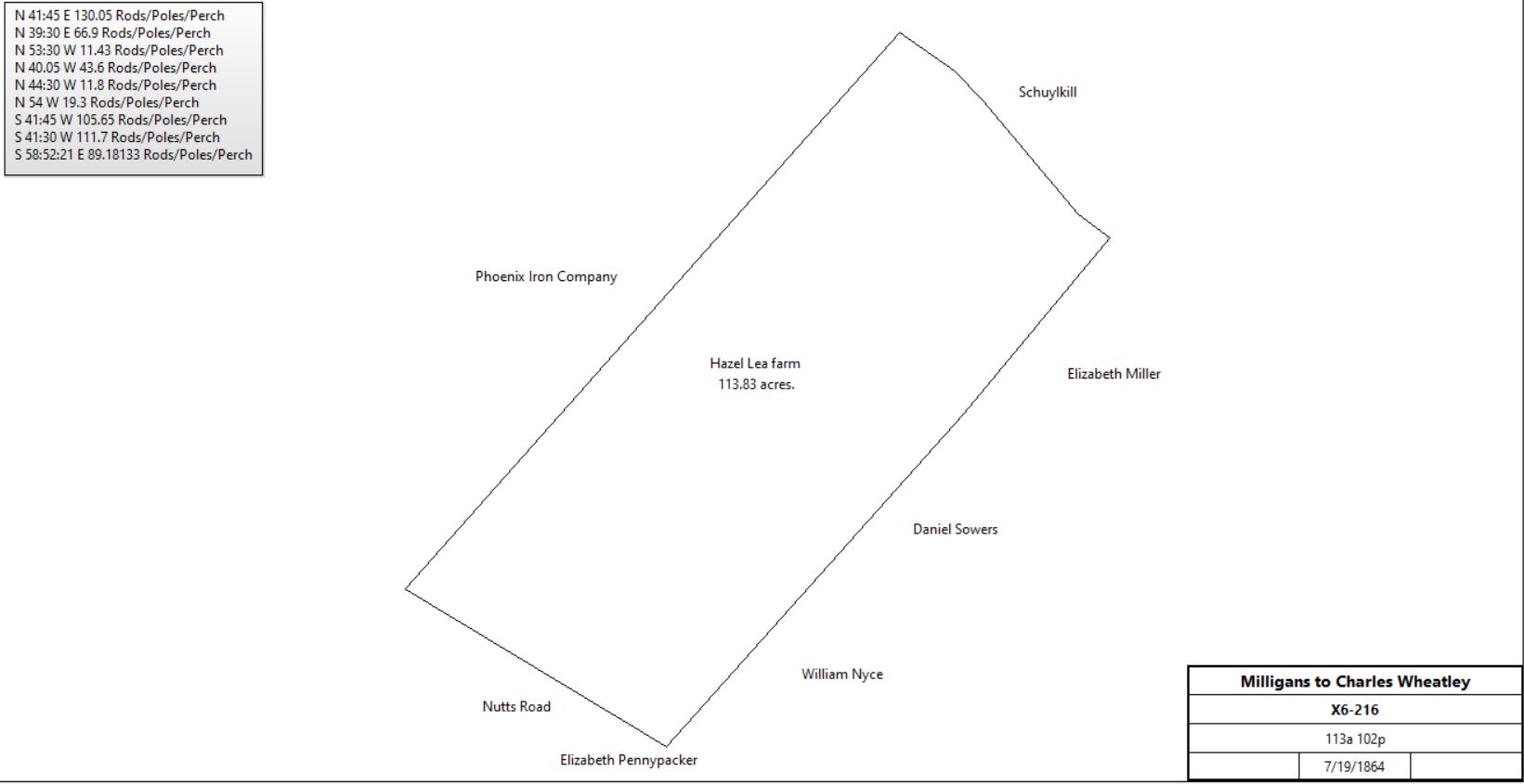
Estate of Benjamin MorrisIn the early 1800s Benjamin Morris amassed a sizeable estate on the eastern side of what was going to become Phoenixville, comprising nearly 500 acres. Many of the purchase deeds for these tracts are unrecorded. When Benjamin died in 1841 he had not written a will, but had described his wishes in a memorandum. His heirs, his 2 daughters, Harriet and Ann followed his wishes, and put his property into a trust. After they, and 2 other family members, had died, the property descended to the 4 children of Benjamin’s niece, Anne Milligan. In 1864 the children, Ann, Hannah, Martha, and James Milligan, agreed on a division of the estate. Martha Milligan was married to the mining engineer, Charles Wheatley. In the property split, she obtained the Morris mansion, the Knoll. Hannah sold her property to Charles Wheatley, comprising the farm he called Hazel Lea. James lost his property in a Sheriff’s sale and the area west of Main Street and south of Nutt Road was split into housing lots. Ann sold a majority of her property and a significant part of it was developed for housing by Mahon Miller and Samuel Latshaw. This tract was east of Bridge Street and south of Nutt Road. The death of Benjamin Morris is recorded in Mary Walker Robert’s diary: ‘Benjn (Benjamin) Morris was buried at the Valley Church burying ground the 20th of the 8th mo 1841’. Ann, Harriet and Frances (his wife) are listed in the TE Quarterly article: Nineteenth Century Burials in St. Peters Churchyard, but Benjamin is not mentioned.
| ||||||||||||||||||||||||||||||||||||||||||||||||||||||||||||||||||||||||||||||||||||||||||||||||||||||||||||||||||||||||||||||||||||||||||||||||||||||||||||||||||||||||||||||||||||||||||||||||||||||||||||||||||||||||||||||||||||||||||||||||||||||||||||||||||||||||||||||||||||||||||||||||||||||||||||||||||||||||||||||||||||