|
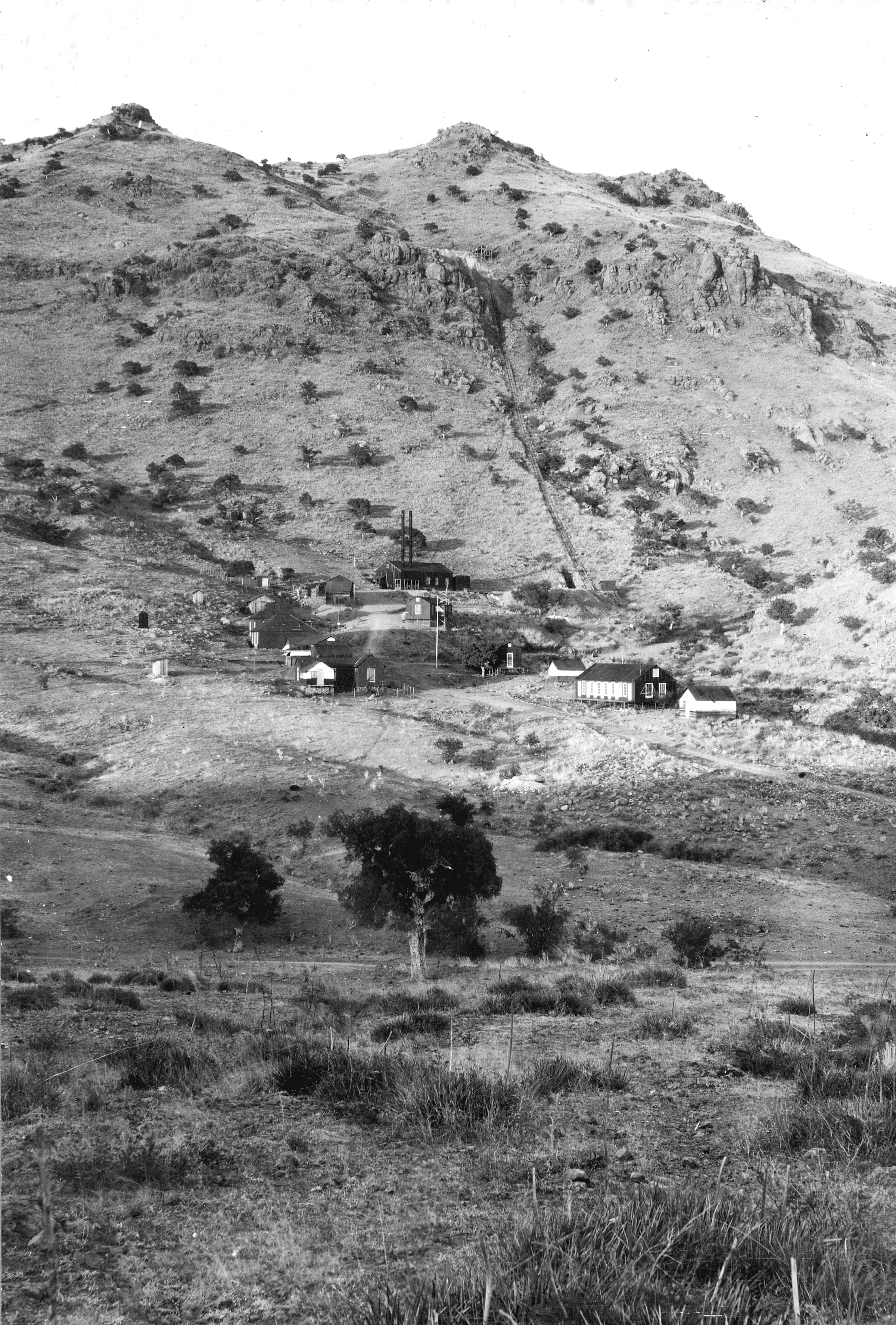
Alto Mine, 1909


Reference [1]
Schrader Report


Reference [1]
Arizona Department of Mines and Mineral Resources Mining Collection
http://docs.azgs.az.gov/OnlineAccessMineFiles/A-B/AltogroupSantacruz8.pdf
Contains reports from 1916, 1928, 1930, 1938, 1944, 1952, 1954, 1956, 1958, 1965, 1967, 1984
Mining District and Mines
Tyndall District - west slope of Santa Rita Mountains 1
Location
S: ½ sec 12; T 21S.; R: 14E; 1
-110.86179, 31.61152 (WGS84)4
Elevation: 16464
Relative Position: 2.5 MI N OF SALERO. ABOUT 1/2 MI NW OF LINEBOY MINE, 3/4 MI NW OF BOUNDARY POST 113 ON MEXICAN BORDER.4
Mineral Products
Cu, Ag, Au, Pb, Zn 1
Geology
 Reference: [1] Reference: [1]
Photographs

Ruins at Alto, 2016, photo by Mike Bertram
Acknowledgements
References
- Mineral Appraisal of Coronado National Forest, Part 12, Santa Rita Mountains Unit, MLA11-94 (1994). SR 591-609
http://repository.azgs.az.gov/sites/default/files/dlio/files/nid1813/usbm_mla_011-94.pdf
- The Mineral Deposits of the Santa Rita and Patagonia Mountains of Arizona, by Frank Schrader (1915) republished by Kerby Jackson under the title of Mining in the Santa Rita and Patagonia Mountains of Arizona. The report is available in electronic form in Google Books, and can be searched. The illustrations have not been found with the article, but are available on the USGS site.
- Photographs and data collected on site visits by Mike Bertram, 2021 onwards.
- USGS Mineral Resources Data System - possibly using NAD72 for locations (https://mrdata.usgs.gov/mrds/map-commodity.html#home)
- http://azbackcountryadventures.com/ contains some of the photos from 1909 Schrader project which are also available on the USGS web site.
- http://docs.azgs.az.gov/OnlineAccessMineFiles/
- Mine.dat has occasional good information, but most is copied from other sources.
|
