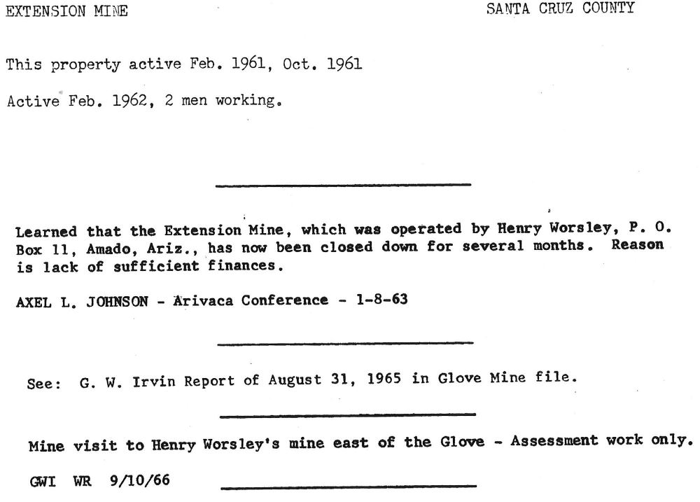
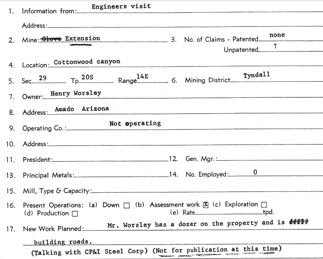
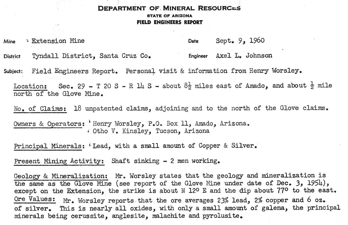
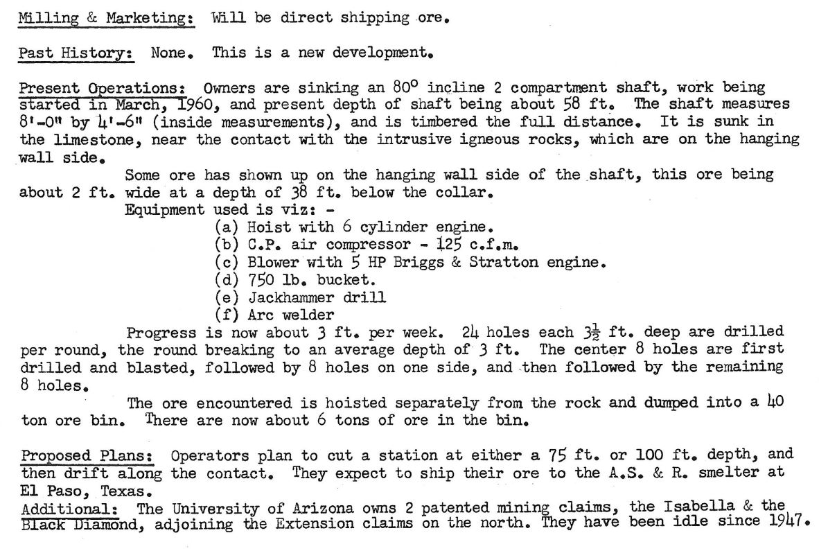
A former underground Pb-Cu-Ag mine/prospect located to the east of the Glove Mine in Cottonwood Canyon on National Forest land. 10.
Ownership
Owned and operated by Mr. Henry Worsley and Mr. Otho Kinsley (1960)10
Location
31.66342,-110.9351510
center W½ sec. 29, T20S, R14E.10
Mineral Products
Pb, Cu, Ag10
3/26/69
Photos
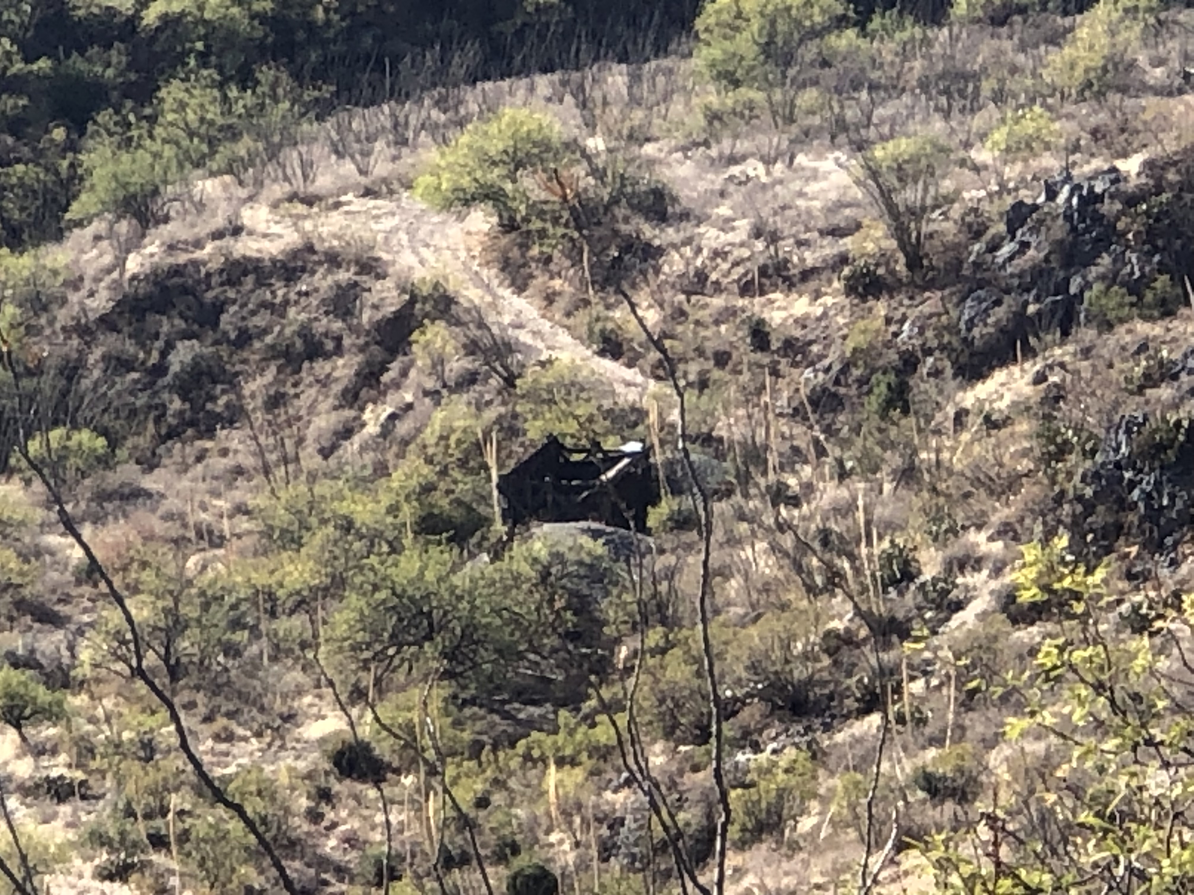
View of mine from the north
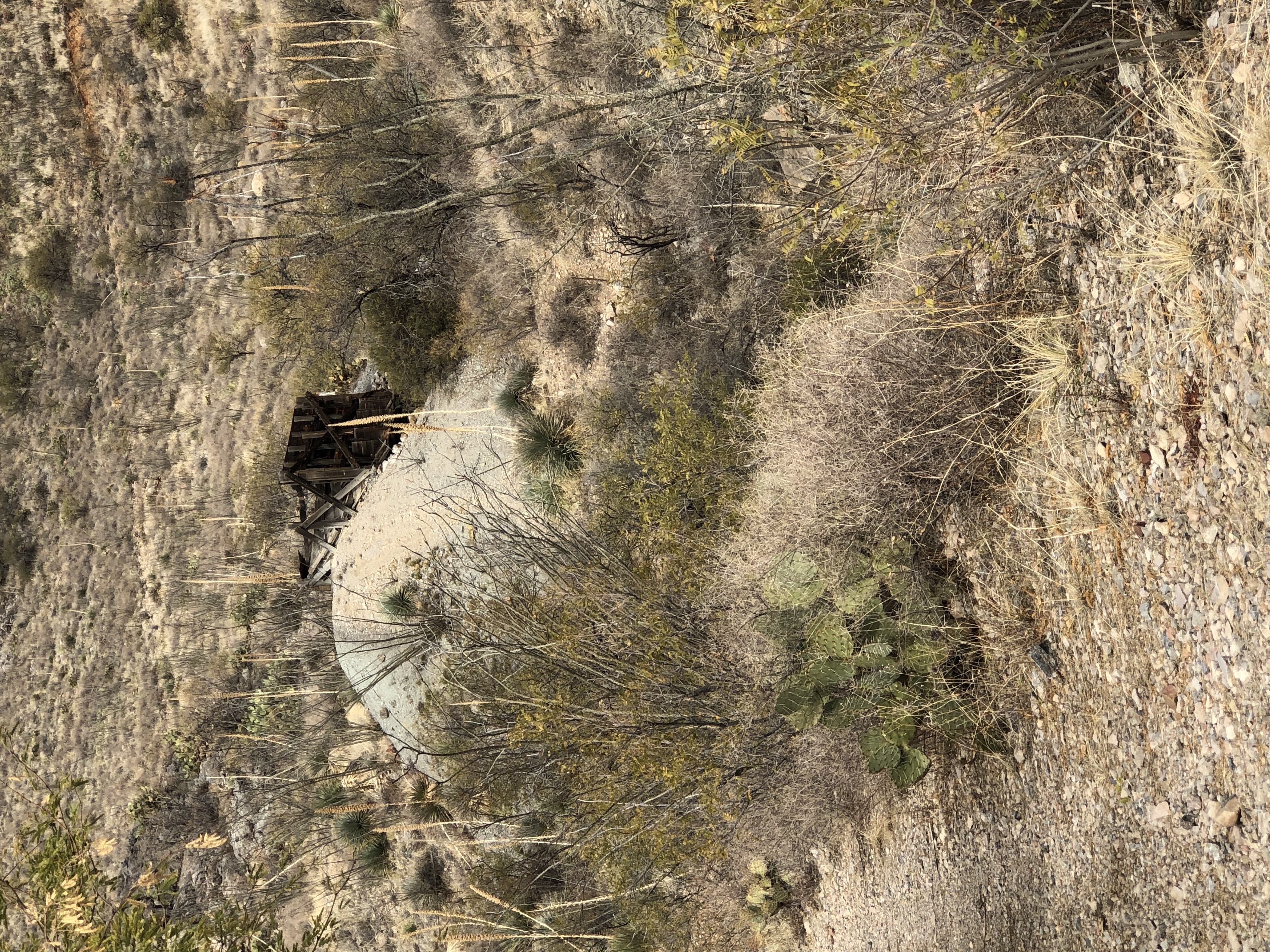
Loading platform
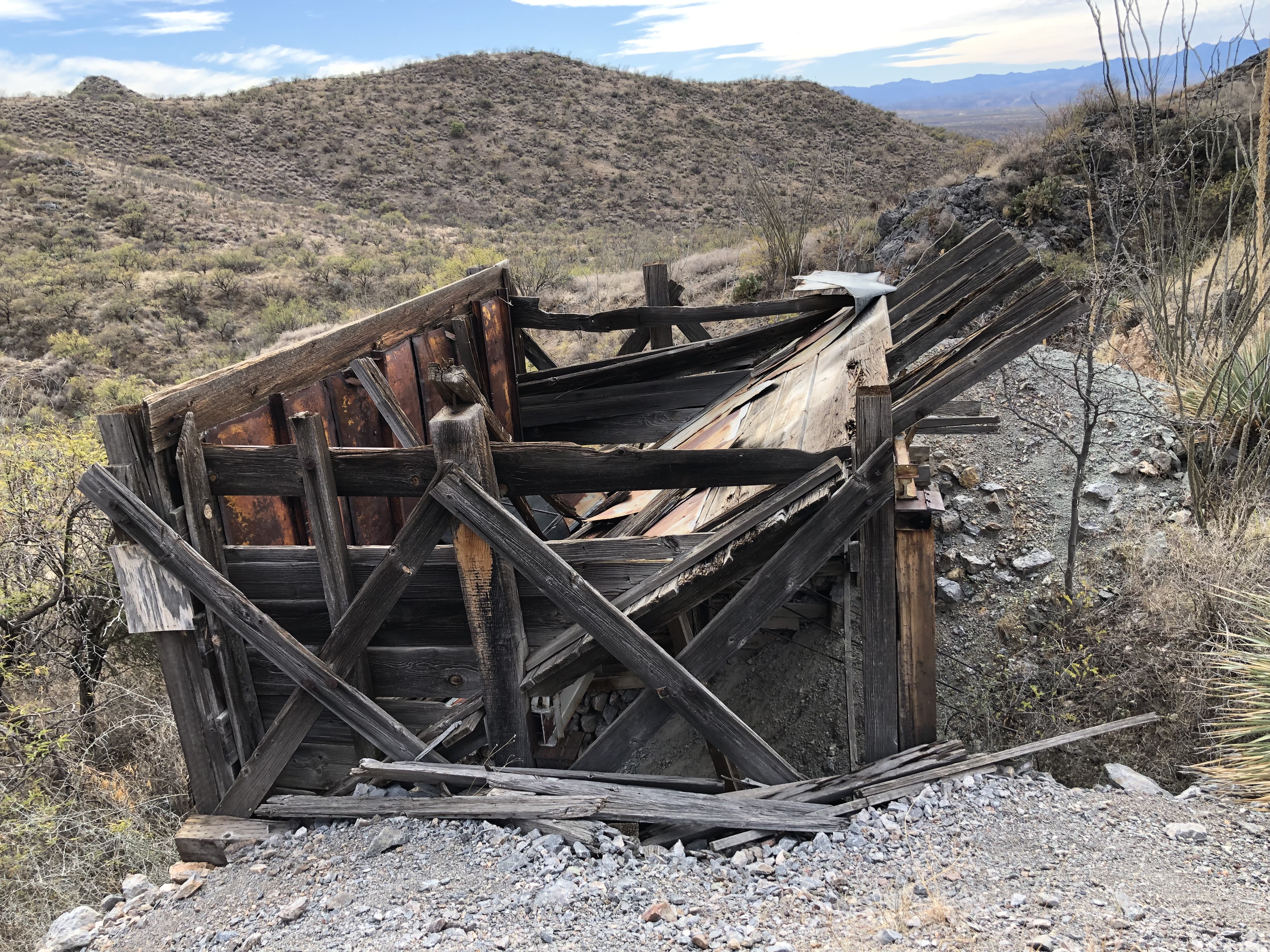
Loading platform 2

Loading platform 3

Shaft
References
- Mineral Appraisal of Coronado National Forest, Part 12, Santa Rita Mountains Unit, MLA11-94 (1994). SR 591-609
http://repository.azgs.az.gov/sites/default/files/dlio/files/nid1813/usbm_mla_011-94.pdf
- Mining in the Santa Rita and Patagonia Mountains of Arizona, U.S. Department of Interior, 1915. Republished 2014 by Kerby Jackson.
- http://docs.azgs.az.gov/OnlineAccessMineFiles/C-F/ExtensionSantacruz11b.pdf
- USGS Mineral Resources Data System - possibly using NAD72 (https://mrdata.usgs.gov/mrds/map-commodity.html#home)
- Index of Mining Properties in Santa Cruz County by Staton B. Keith, bulletin 1991, Arizona Geological Survey, 1975
- Geology of the Three R Mine, Palmetto Mining District, Santa Cruz County, Arizona by Paul Handverger, MS thesis 1963, University of Arizona
- https://mrdata.usgs.gov/mrds/show-mrds.php?dep_id=10046338
- Wikipedia
- https://tucson.com/news/local/three-r-mine-contributed-to-arizonas-rep-for-copper-production/article_2a25e1e1-7280-5fd5-be97-a40732a39b1b.html
- mindat.org
|
