Overview
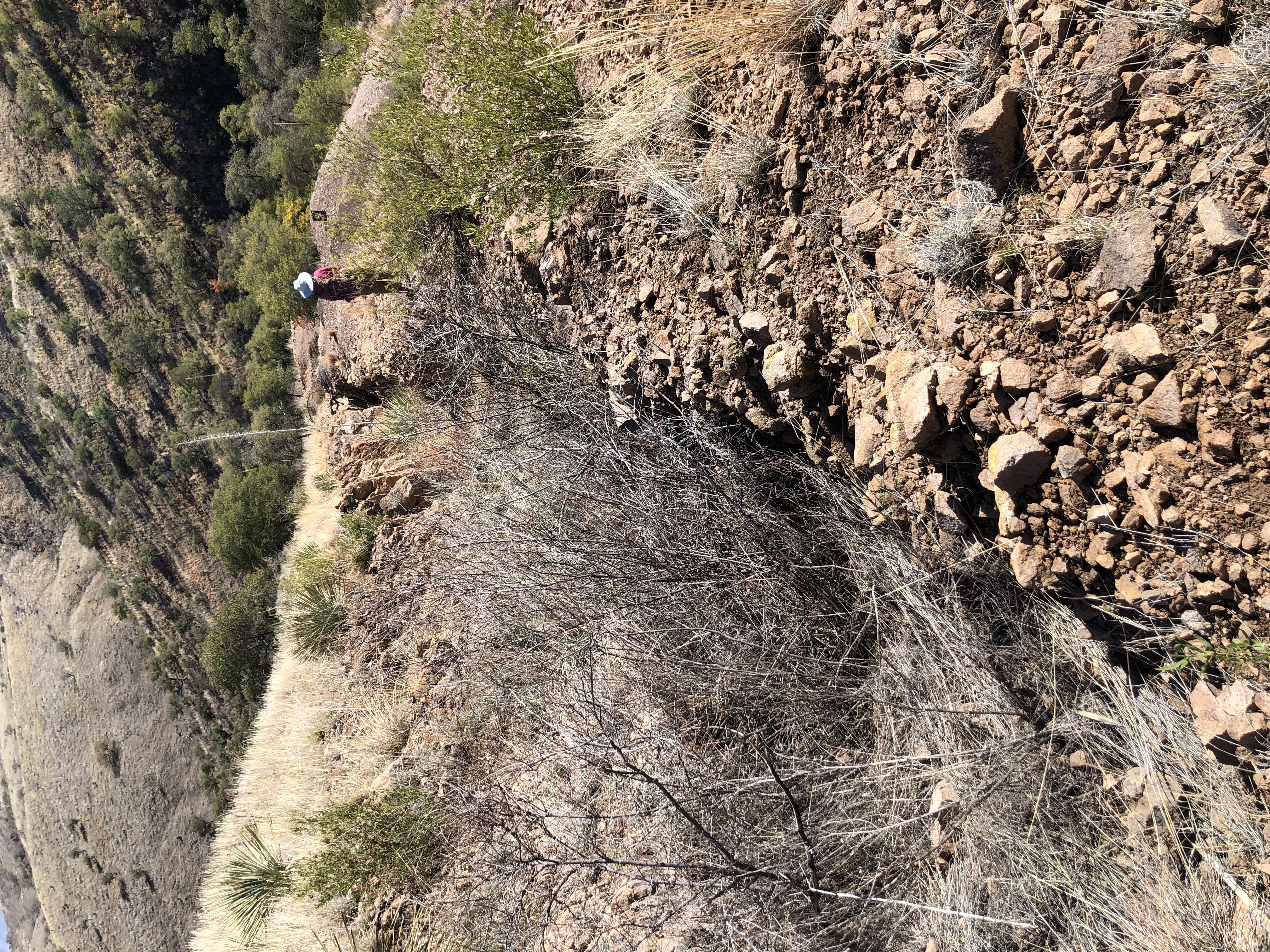
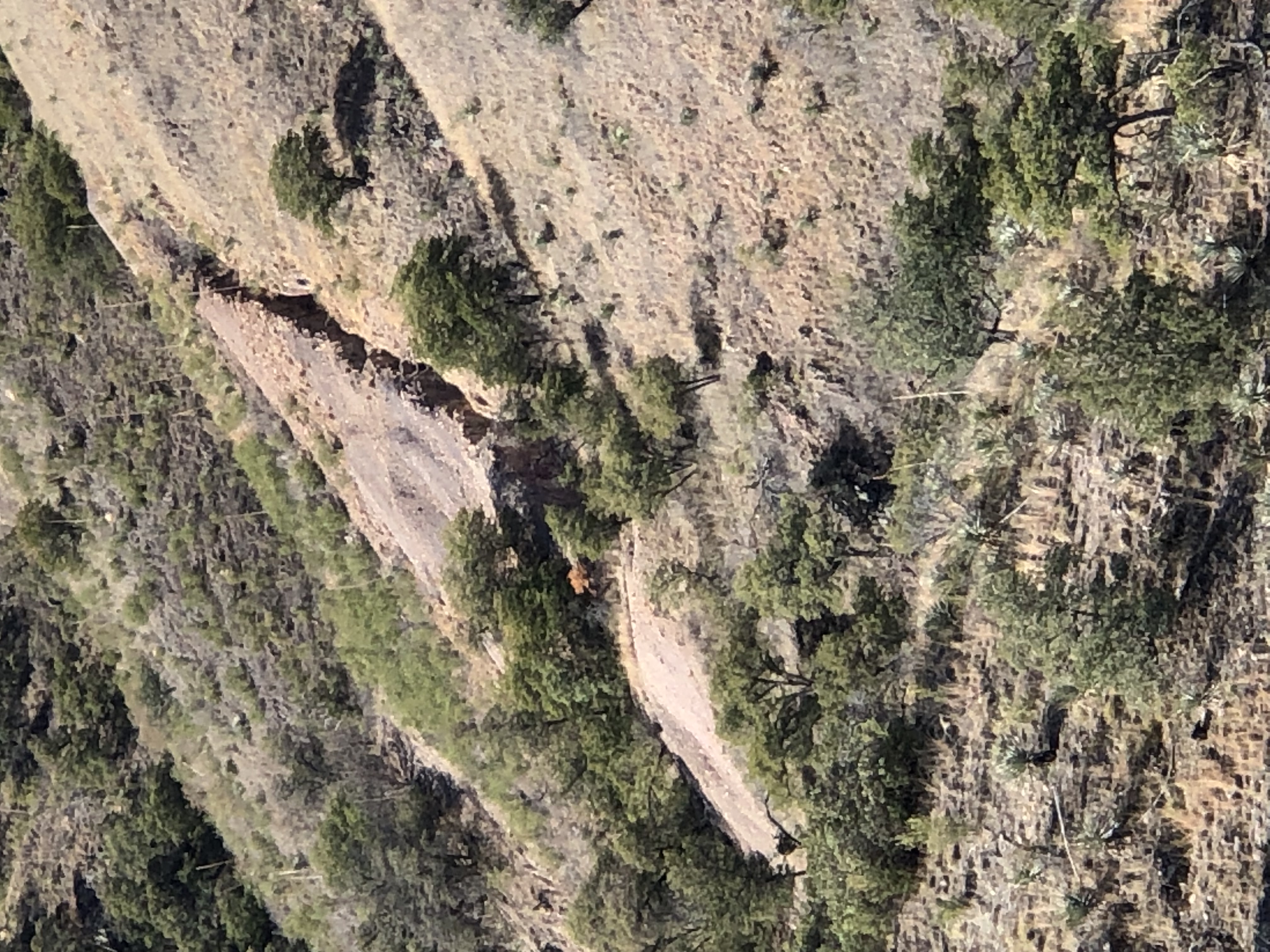
Trench looking down slope
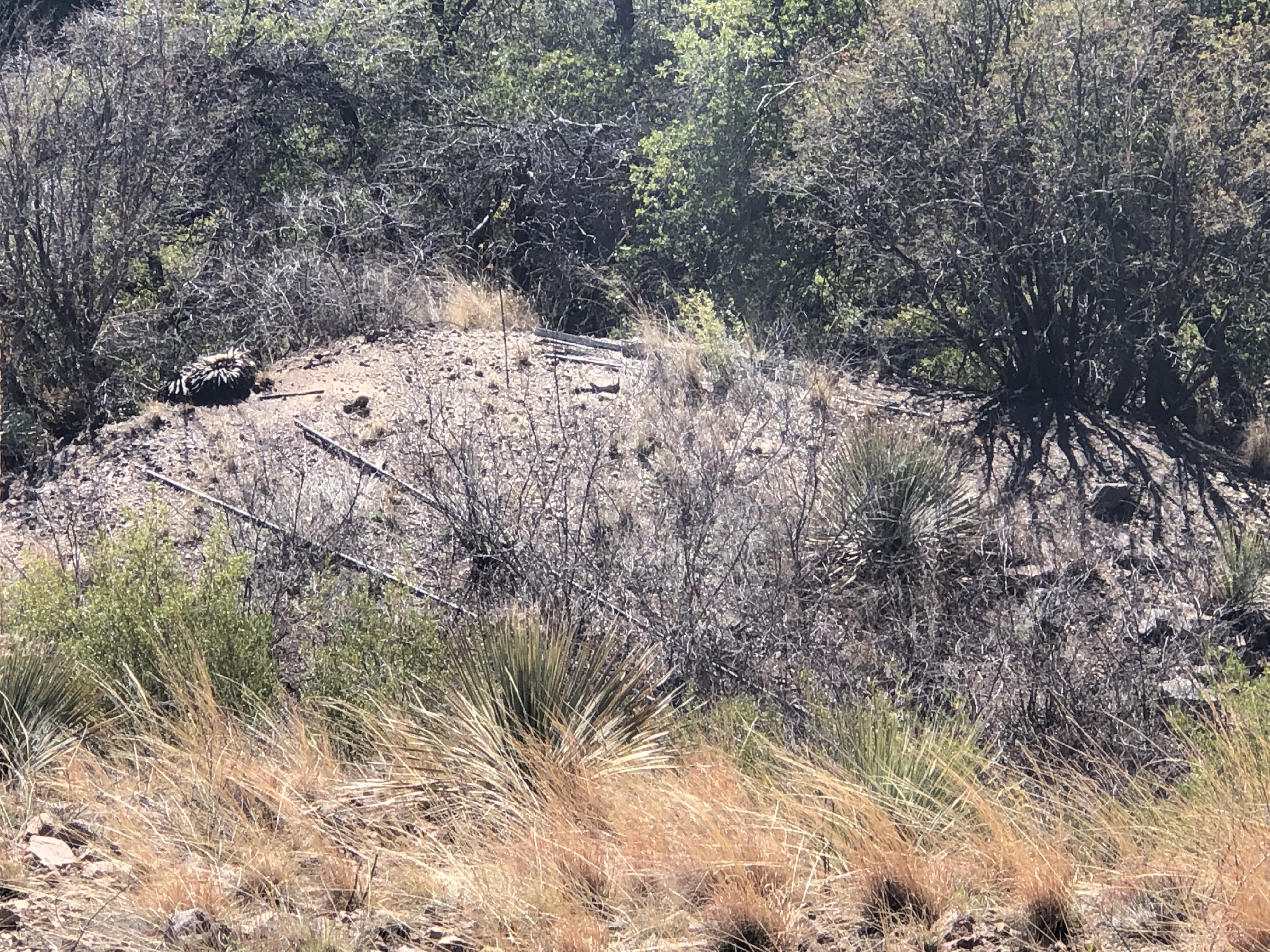
Landing site with rails from mineral railway
[Ref. 2]
Alternate Names
none
Company
Clarke2.
Arizona Geological Survey Mining data
http://docs.azgs.az.gov/OnlineAccessMineFiles/S-Z/SunsetgroupSantacruz200b.pdf
See below


Mining District and Mines
Pajarito District1
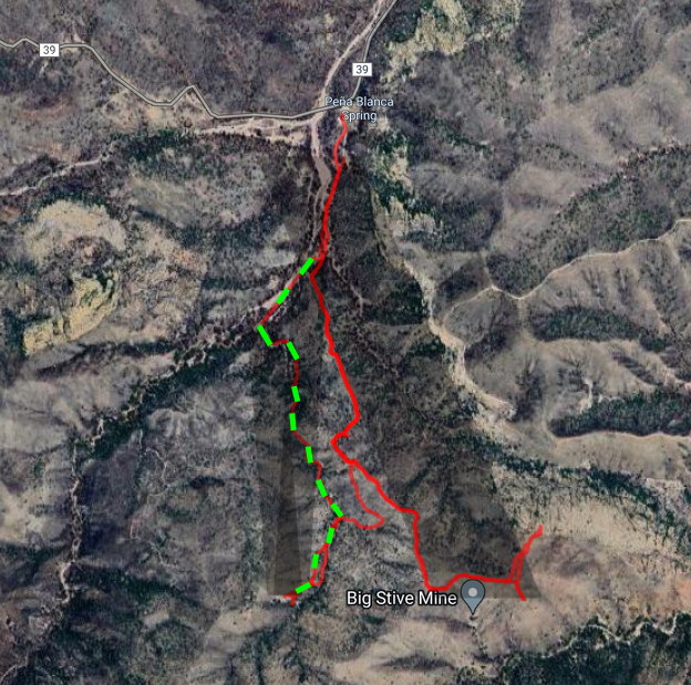
Trail to Sunset mine
Location
31.37431, -111.097353
31.3748, -111.0943 bottom of trench2
31.3742, -111.0947 landing area2
References
- Index of Mining Properties in Santa Cruz County, Arizona, by Staton B. Keith, Bulletin 191, Arizona Geological Survey, 1975. No entry
- Mike Bertram
- MRDS records
- Mineral Appraisal of Coronado National Forest, Part 7 - Patagonia Mountains - Canelo Hills Unit by Mark Chatman, 1994, No entry
- Arizona Department of Mines report: http://docs.azgs.az.gov/OnlineAccessMineFiles/A-B/BilliedSantacruz65.pdf
- The Mineral Deposits of the Santa Rita and Patagonia Mountains by Frank C. Schrader, 1914 - no entry
- Heylmun, Edgar B., The Pajarito Mining District, California Mining Journal, v.53, #7 (1984)
|
