|
|
|
Mines Menu:
Mines Map
Use the links at the left to return.
|
|
Draft Mine Report |
|
Total Wreck Mine | |
|
Schrader Report, 1914
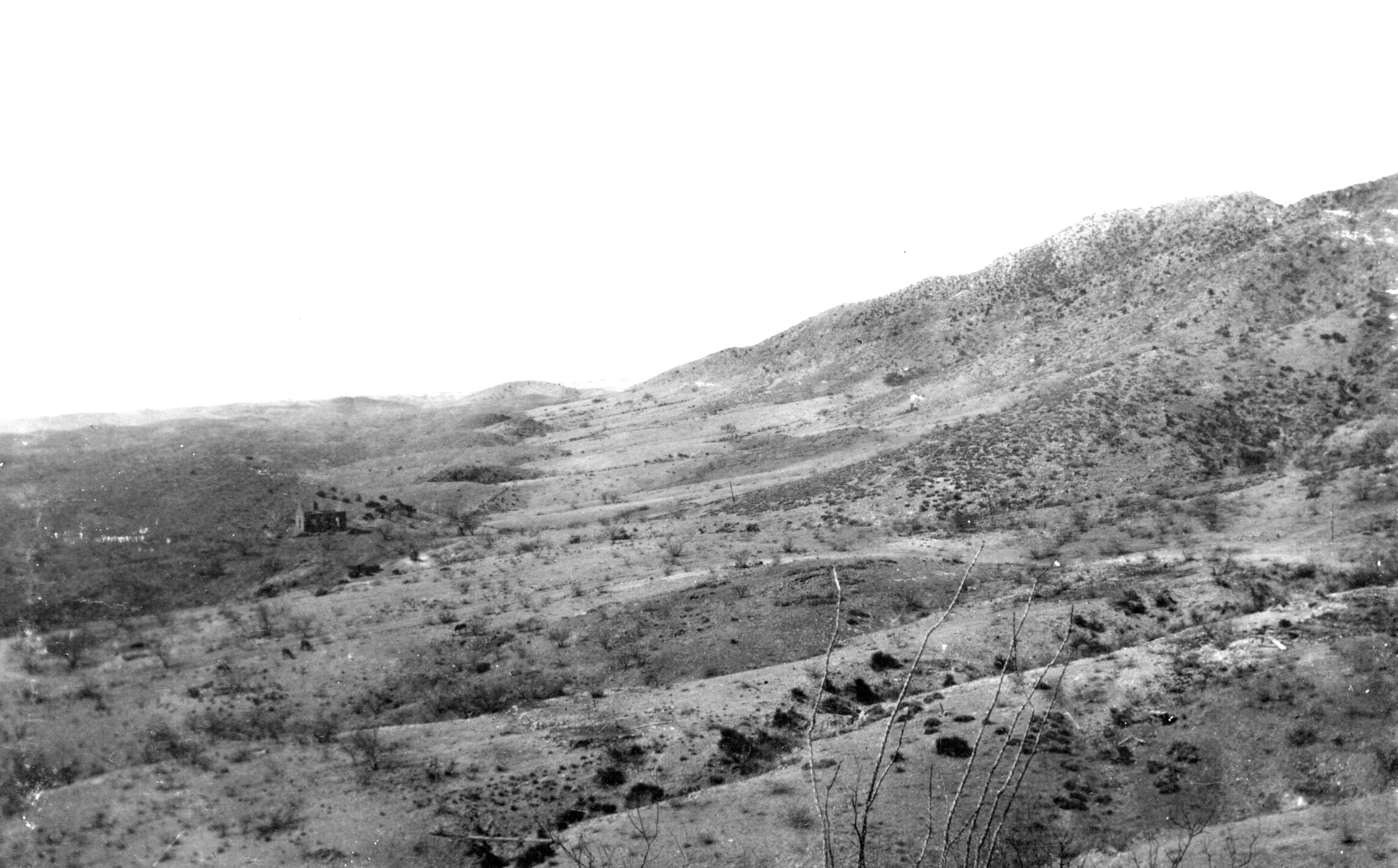
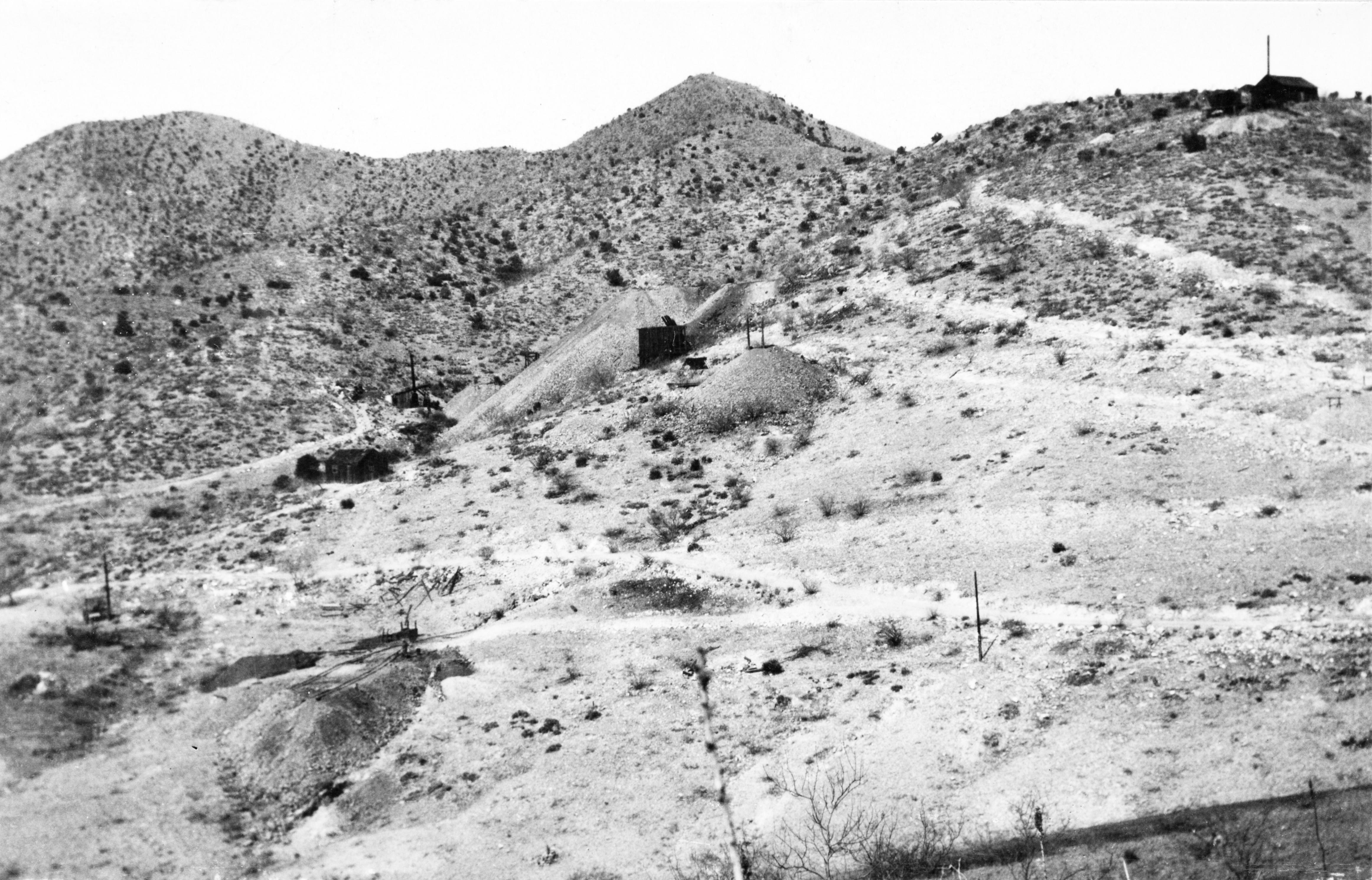
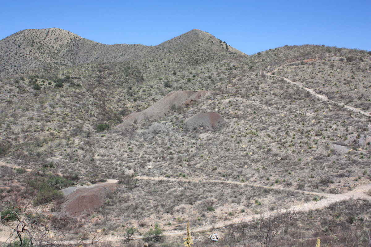
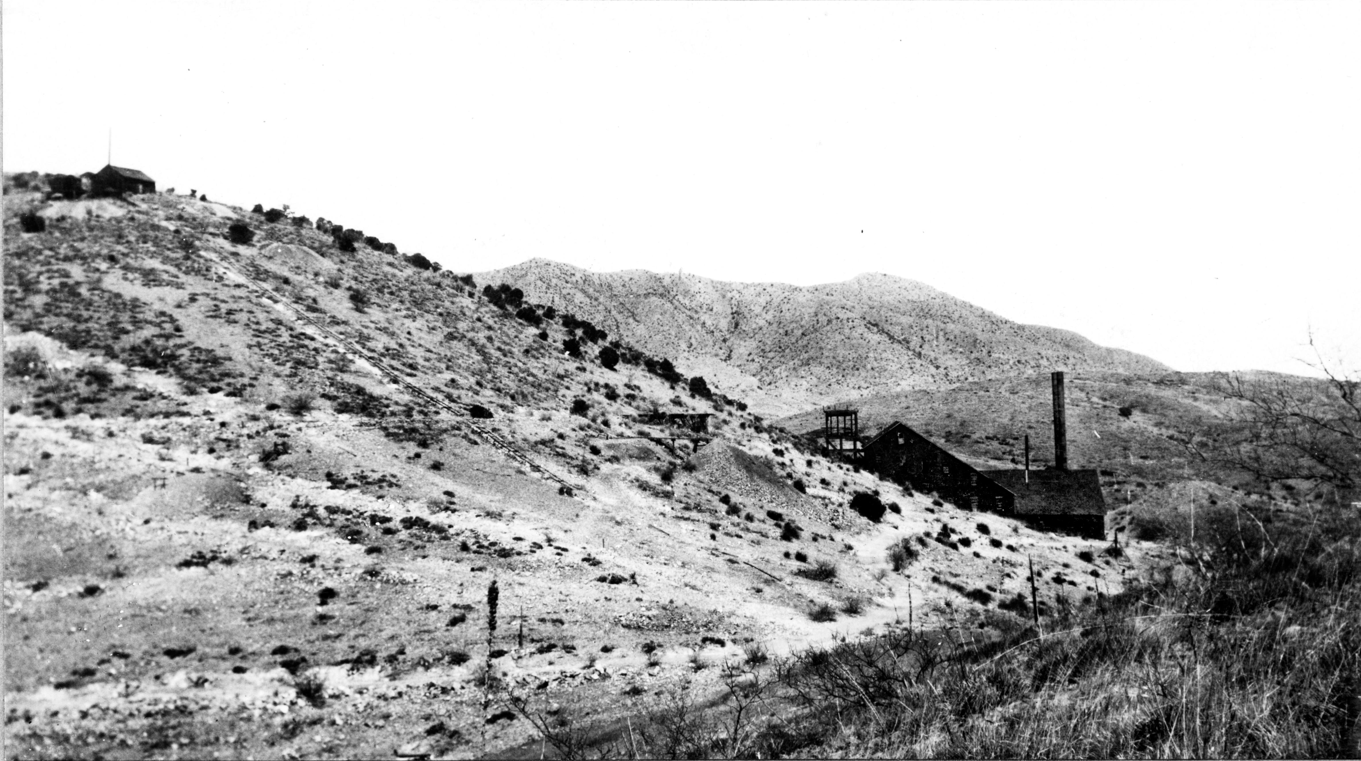
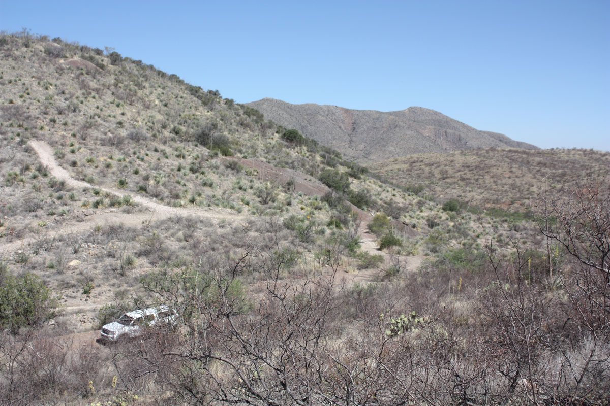
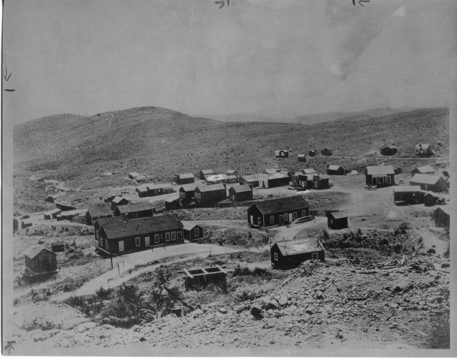
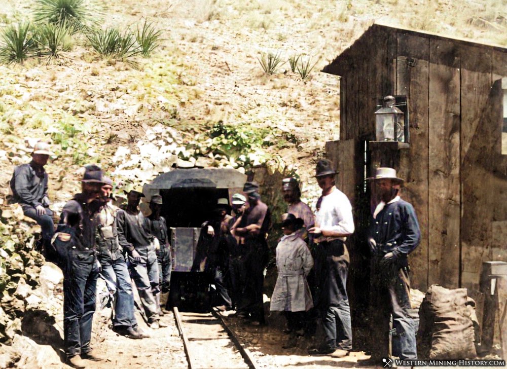
Reference [2] Arizona Department of Mines and Mineral Resources Mining Collection Mine.dat description: A former underground Pb-Ag-Cu-Mo-Au-Mn-V mine located on 7 claims, several of which are patented, in East-central sec. 3, T.18S., R.17E., 7 miles south of Pantano on Cienega Creek, northeastern part of the Empire Mountains, at an altitude of 4,600 feet. Discovered in 1879 by Mr. John Dilden, a cowboy. Owned by M. Bonner Denton. Operated at times, or in part, by the Empire Mining & Development Co. (1881-1882); Vail & Gates (1884 by tax auction until at least circa 1915); C.T. Roberts (1907-1908); E.P. Drew (March, 1909-1911); Schley; Adams & Saxby; Gardner & Young; and, Torres. Mineralization is secondary lead, copper and silver minerals with minor lead and copper sulfides in irregular replacement orebodies in badly faulted Permian limestone beds intruded by Laramide diorite stringers and dikes. The ore zone is 2.44 meters wide, depth to bottom of 152.4 meters, 30.48 meters thick, strikes NW and dips 85NE. There are 3 major vein systems. The principal vein is 5 feet wide. Silver values decrease and copper values increase with depth. This mine is within the Permian Snyder Hill formation, which consists of thin-bedded gray and black limestone and dolomite together with thin beds of quartzite. Basal Cretaceous conglomerate overlies the Snyder Hill on the southeast. Small dikes of diorite intrude these rocks. In general the beds strike N.60°E. and dip 35°SE. Immediately north of the mine is the Andrada fault, whose irregular outcrop averages NW in strike and 85° NE in dip. Hence, the rocks in the vicinity of the mine are affected by faults and fissures of east-west and northeasterly trend and somewhat folded. Vein No. 1, or North fissure, and Vein No. 2, or South fissure, are 90 feet apart, strike east-west, and dip 85°N. Intersecting them with downthrown side on the southeast is the Main vein or fault, which strikes N.30°E., dips 85° southeastward, and disappears under low-angle faults on the SW. The ore deposits occur within zones of the No. 1 and No. 2 fissures and Main fault and as replacements extending from them along bedding planes of the limestone. The 'veins' are 6 to 8 feet wide. The replacements extend outward for a few feet to about 100 feet, both above and beneath beds of quartzite, north from the No. 1 and No. 2 veins and on both sides of the Main vein. The ore occurs within altered, more or less crushed, limestone with calcite and cellular quartz. Associated with the mineralization in places, as on the 450 level, is breccia 40 to 50 feet wide, together with some light-colored clay material. The ore is essentially all oxidized. The host rock units are the Concha Limestone and the Rain Valley Formation. An associated rock unit is the Sycamore Canyon Quartz Monzonite. A local structure is the Andrade Fault with a strike NW and dip of 85NE. Workings include shafts, adits, drifts, inclines, winzes, and stopes, which aggregated about 5,000 feet (1,524 meters) of workings by 1910. The mine is developed to approximately 500 feet (152.4 meters). Worked from the 1880's to 1940. Produced some 14,000 tons of ore averaging about 8% Pb, 7 oz. Ag/T and minor Cu and Au. Some 8 tons of molybdenum concentrates were shipped in 1918. Of this, more than 10,000 tons was produced before 1902 and 7500 tons worth $450,000 after 1902. The mine can be reached by a road from state highway 83, which has several forks and runs through mostly private land, or from a road off interstate highway 10, which runs mostly through state land but is very rough. For a more historical account of the mine and its environs, see: Total Wreck Mine and Ghost Town Mining District and MinesEmpire District - northeast of Santa Rita Mountains 1 Location018S 017E 03 CENTER OF E4 31.89556,-110.592227 -110.59261, 31.89569 (WGS84)4 Elevation: 4600 ft.4 Relative Position: 7 MI S OF PANTANO ON CIENEGA CREEK.4 Mineral ProductsCu, Ag, Au, Pb, Mo 4 No additional photos at present AcknowledgementsErnie Parks provided photographs for this report and also help find the location of the 1909 photographs from Schrader. References
MB v1.0 12/2022 |