|
|
Arizona Trails and Mines Reports | |
Trails map :
Trail Reports list
Use the link at left to return to the trails map.
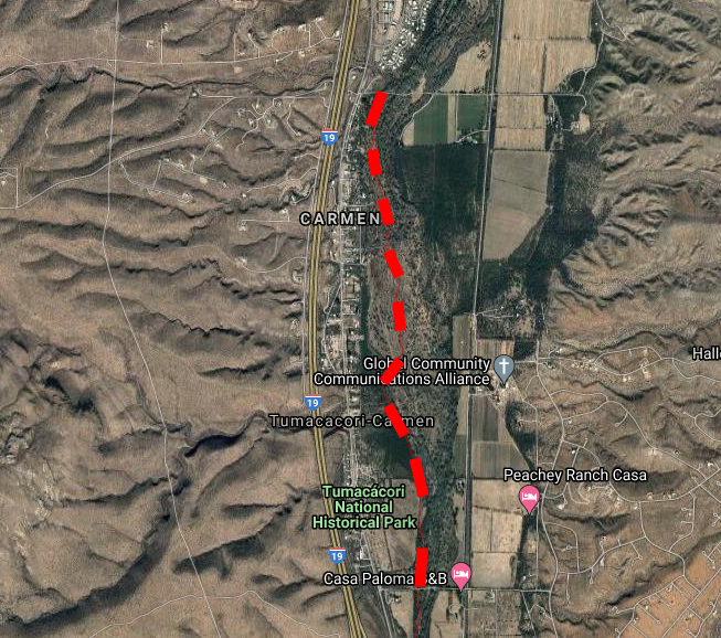
Trail Report: De Anza Trail - St. Geratudis Lane to Clark’s CrossingReporters: Mike Bertram & Kathy King Date: January 12, 2022 | |
| |
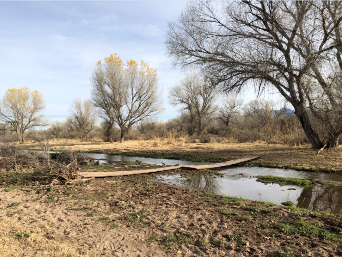
Description: reasonable state with two river crossings. GPS Readings: Ends: 31.5621N, 111.0470W and 31.5950N, 111.0495W The trail section is 2.8 miles long. | |
| |
River Crossing | |