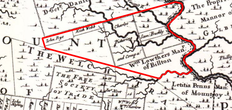
 Charlestown Deed HistoryIn the early 1680s William Penn asked his Surveyor-General, Thomas Holmes, to produce a map of the assigned land in Pennsylvania. The map eventually was published in 1687. Below is an extract of the map with the future boundaries of Charlestown added in red. | |||||
 |
|||||
The John Bye and Richard Webb patents never seem to have been completed and were ignored by later patents. |
|||||