 | |
|
Tredyffrin Easttown History Home
Use the links at the left to return.
|
|
 Easttown Deed History | |
|
William Shardlow (c. 1624 - 1700), a London Quaker, did not immigrate to Pennsylvania. He served on the council of the Free Society of Traders in England (ref.: William Penn and the Founding of Pennsylvania). | |
| |
| The following documents and maps show the land ownership in Easttown at significant times. 1715 was the first tax return for the township; 1777 the year when the British Army traversed the township and plundered it; 1796 was when the tax returns described the buildings and renters. The 1883 map is an electronic version of the first detailed map of the township. There are a number of gaps in this deed history at this time. In the 18th century these are due to deeds not being recorded or being recorded outside Chester County (for example, in Philadelphia). In the 19th century the issue is the large number of deeds. These latter gaps will be filled on an ‘as needed’ basis. | |
AcknowledgementsThese deed histories are based on research at the Chester County Archives and was supported by the ever helpful Archives staff. | |
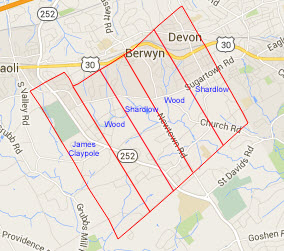
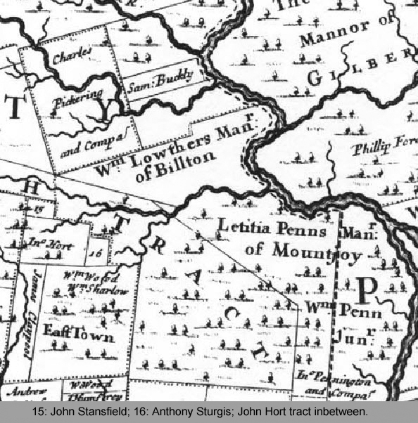 In 1681 William Shardlow and William Wood purchased 5,000 acres of land from William Penn. 3,380 acres of this land was surveyed in one block which encompasses what is now the majority of Easttown township. In the same year James Claypole purchased 1050 acres which constitutes the western part of Easttown township.