|
Note: in these deed histories distances are quoted in perches (p) of length 16.5 feet. Areas are quoted in acres (a) and square perches (p). There are 160 square perches to an acre. In a few cases roods (a quarter of an acre) are also used.
Reference: Garry Wheeler Stone. "The Mount Joy Forge on Valley Creek." In The Scope of Historical Archaeology: Essays in Honor of John L. Cotter. Edited by David G. Orr and Daniel G. Crozier. Philadelphia: Temple University Department of Anthropology, 1984. Page 102.
|
|
|
From |
To |
Date |
Area |
Cost |
Reference |
|
|
|
|
|
|
Warrant |
Peter Mather |
3/17/1757 |
96¾a |
|
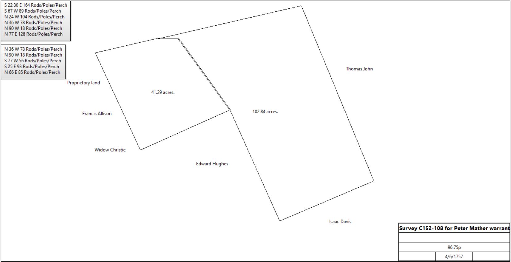
Survey C152-108 (1757). Owned 90 acres by 1760 tax |
|
Peter Mather |
John Potts |
1761 |
96.75a |
|
Stone: Springfield tract |
Commonwealth |
Isaac Potts |
7/15/1791 |
96¾a |
|
Patent P18-179 from Peter Mather’s warrant/survey M-183 4th, survey C152-108 |
Isaac & Martha Potts |
John Davis |
11/16/1791 |
32¼a |
£83 4s |
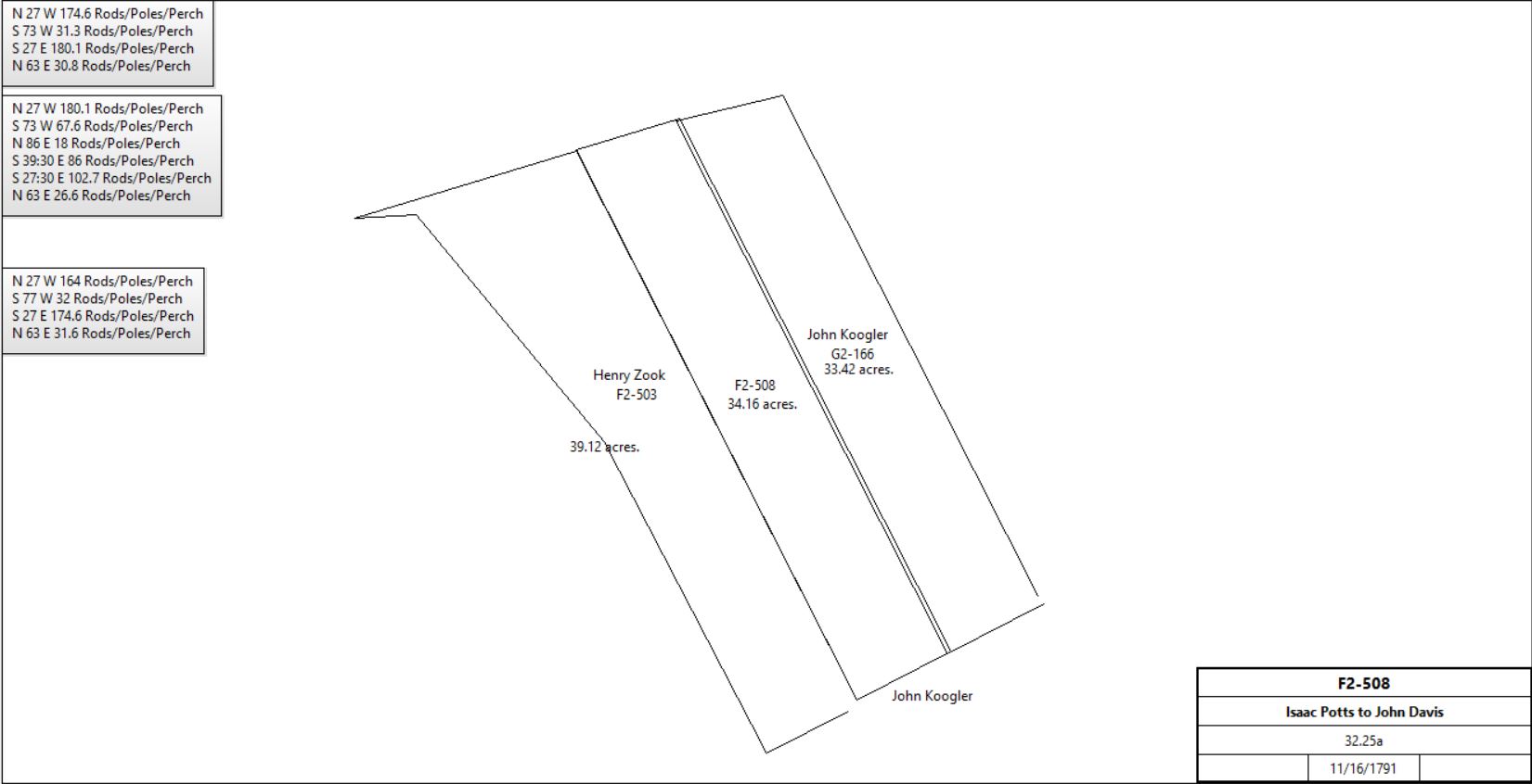
F2-508; see deed plan |
Isaac & Martha Potts |
John Koogler |
11/16/1791 |
32¼a |
£83 |
G2-166; see deed plan |
Isaac & Martha Potts |
Henry Zook, miller |
11/30/1791 |
32¼a |
£83.45 |
F2-503 Western portion of Springfield; see deed plan |
|
|
|
|
|
|
see Table G for Zook sales to Adam Siter |
Henry & Barbara Zook |
John Garber |
3/24/1797 |
108a |
£1215 |
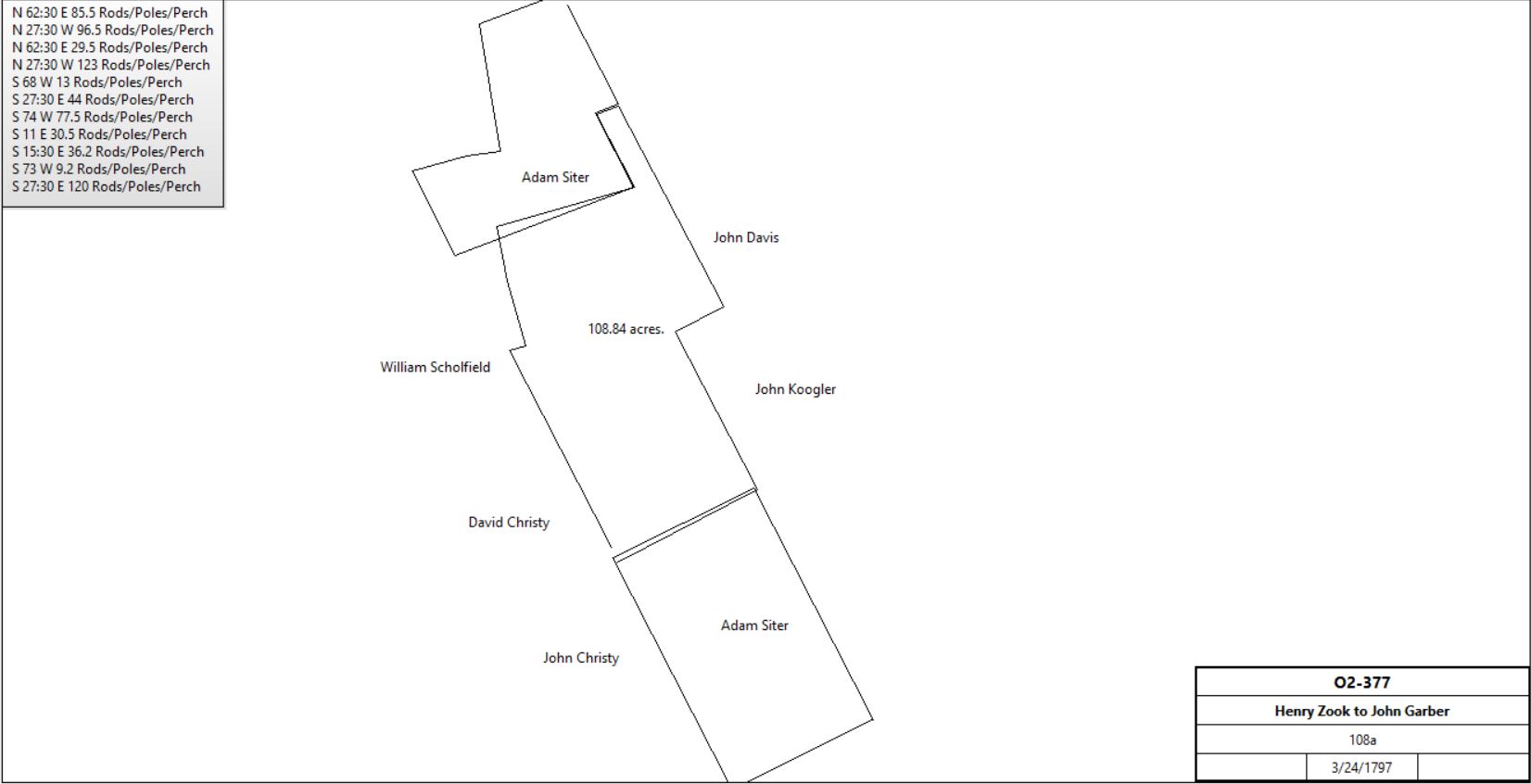
O2-377 |
|
John Davis |
|
1798 |
32a |
|
Glass tax; hill land |
John Koogler |
|
1798 |
34a |
|
Glass tax; hill land |
John Garber or Garner |
|
1798 |
107a |
|
Glass tax; stone house 30’ x 16’ |
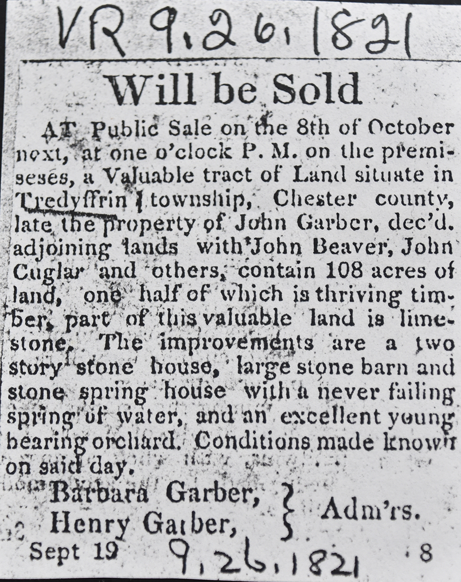
Village Record 09-26-1821
See Newspaper clipping in Document database for commentary
|
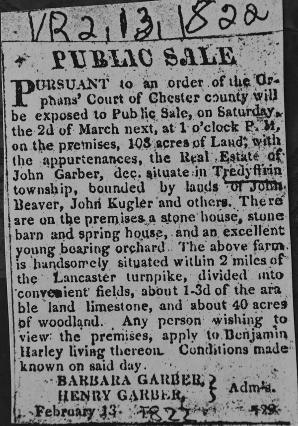
Village Record 02-13-1822
See Newspaper clipping in Document database for commentary
|
John Garber |
Henry Garber |
3/25/1823 |
108a |
$3240 |
W3-87 |
Henry & Elizabeth Garber |
Samuel Jones |
3/31/1825 |
108a |
$3672 |
X3-478 |
John Garber |
Jacob Beitler |
9/1/1845 |
6a |
|
C5-91 |
Samuel Jones |
Ann Garber, daughter |
2/9/1851 (Orphans Court) |
108a – 6a |
|
Died intestate |
Ann Garber |
John Beaver |
2/9/1851 |
108a – 6a |
$6120 |
M5-539 |
Estate of John Beaver |
Alexander Holland |
4/1/1853 |
108a – 6a |
|
T5-109 |
Alexander Holland |
Samuel J. Garber |
4/1/1874 |
108a – 6a |
$10,500 |
H8-50 |
Samuel J. Garber |
Archibald Russell |
6/3/1874 |
108a – 6a |
$7,500 |
N8-210 |
Samuel J. Garber |
Archibald Russell |
6/22/1878 |
12a 107p |
$1 |
A9-104; inherited from John Garber |
Archibald Russell |
Restore B. Lamb |
6/4/1881 |
108a – 6a |
$11,000 |
J9-186 |
Valentine Kugler |
Jesse H. Dice |
3/20/1854 |
7a 6p |
|
V5-241 |
William Davis & wife |
Jesse H. Dice |
12/30/1826 |
2a 33p |
|
G3-381 containing 2a 33p |
Gabriel McCahan et al, heirs of Jesse Dice |
Restore B. Lamb |
7/5/1881 |
7a 6p & 2a 33p |
$1800 |
J9-196 |
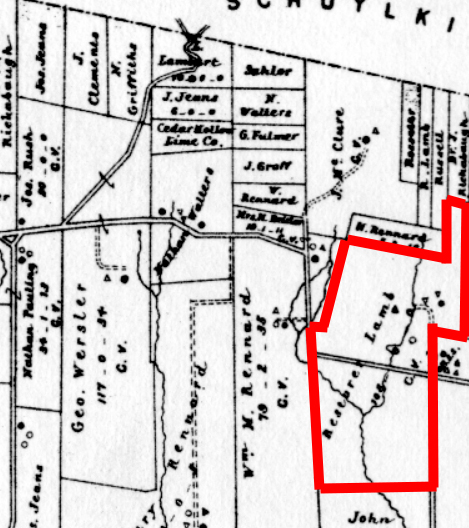
Breou’s atlas
|
Restore B. Lamb |
|
1883 |
108a |
|
Breou’s atlas |
Restore B. Lamb |
Adam Anderson Golder |
3/1884 |
7a 6p & 2a 33p? |
$2500 |
V9-250 |
John Simpson |
|
1897 |
|
|
Atlas |
Mary Rainer TenBroeck |
|
1912 |
|
|
Mueller’s atlas |
Mary Rainer TenBroeck |
Philip TenBoeck |
|
|
|
Brother |
|
Henry Woolman |
1929 |
Part |
|
|
Edward Tenbrook |
|
1933 |
10a |
|
Atlas |
Henry N. Woolman |
|
1933 |
116a |
|
Atlas |
Edward H. Tenbroeck |
|
1950 |
10a |
|
Atlas |
Henry N. Woolman |
|
1950 |
112a |
|
Atlas |
|
Albert Zug |
|
|
|
Craig TenBroeck |
|
|
|
|
|
|
|
|
Note: The farmhouse has a 2 bay core attributed to around 1730 (that is most unlikely).
J9-186 Beginning at a stone in the line of Deborah Beaver’s land (Now John Groff) thence by said land N62°30’E 85.5p to a stone set in the line of Valentine Krugler’s land (now John Krugler), thence by said land N27°30’W, 96.5p, thence N62°30’E 29.5p to a heap of stones, thence by land now or late of John Davis N27°30’W 123p to a heap of stones set for a corner of lands formerly of Adam Siter. Thence by the same S68°W 13p to a heap of stones, thence 27°30’E 44p to a heap of stones, thence S74°W 77.5p to a corner of Jacob Beitler’s land (now Israel Beitler), thence by the same S11°E 30.5p to a white oak, thence S15°30’E 36.2p to a rock, thence S73°W 9.2p to a stone, thence S27°30’E 120p to the place of beginning. Excepting 6a which John Garber & wife conveyed to Jacob Beitler, C5-914, 9/1/1845, the same as Samuel Jones Garber & Sarah Emma, his wife conveyed to Archibald Russell N8-210 or 21, 6/3/1874.
J9-196 #1: Beginning at a stone a corner of land formerly of Jesse H. Dice, thence by the same N24¼°W 22.44p to another stone in the edge of a public road; thence along the edge of said public road N65¼°E 43.88p to a heap of stones, thence by land formerly of Valentine Krugler S25°E 29.2p to a corner in a public road being 8½’ from the northern edge of said public road, thence along said road S74°W 44.44p to the place of beginning. 7a 16p
#2: Beginning at a post near an old stump in the line of land now or late of John Garber, thence along the same S63¼°W 16.8p, thence along land of said Gerber S27¾°E 20p, thence N71°E 16.8p, thence N27°W 22.3p to the place of beginning. 2a 33p
|
|
Table D.1 John Potts / Henry Zook patent
|
From |
To |
Date |
Area |
Cost |
Reference |
|
|
|
|
|
|
James John |
|
3/9/1759 |
39a |
|
Warrant J-47 2nd 30a |
|
John Potts |
1761 |
39a |
|
Stone: Chestnut ridge |
Samuel & John Potts, assignees of James John |
|
3/1765 |
|
|
Survey S-174 |
Commonwealth |
Henry Zook |
6/10/1796 |
39a |
|
Patent P29-109 Chestnut ridge |
Henry Zook |
John Stewart |
6/16/1796 |
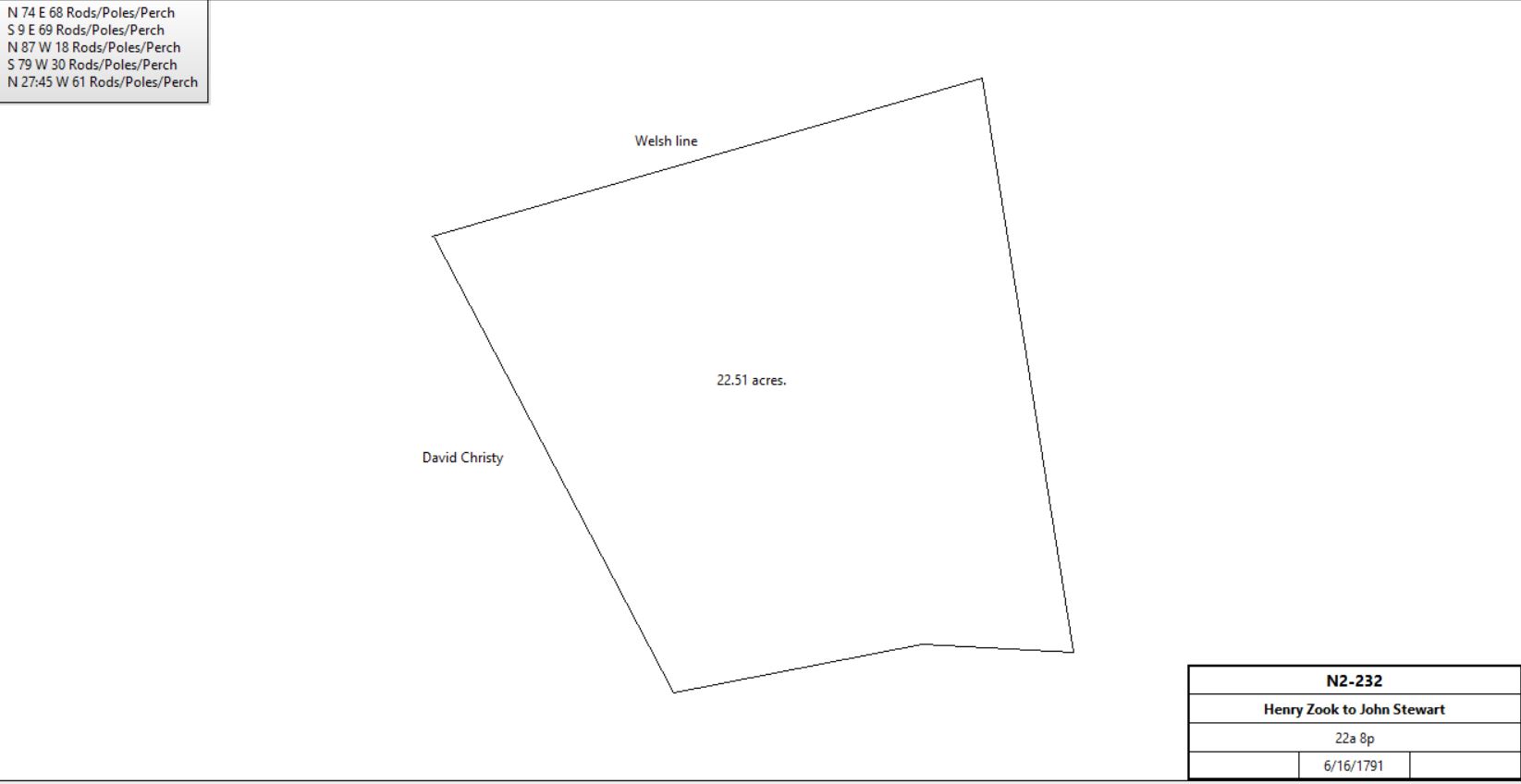
22a 8p |
$213 15s |
N2-232 |
|
Isaac Potts |
Henry Zook |
6/16/1798 |
39a |
£50 |
F2-510; do not understand |
John Stewart |
|
1798 |
22a |
|
Glass tax |
John & Margaret Stewart |
Peter Supplee |
2/3/1802 |
23a 51p |
|
W2-279 |
Peter & Hannah Supplee |
Spicer Hall |
4/8/1803 |
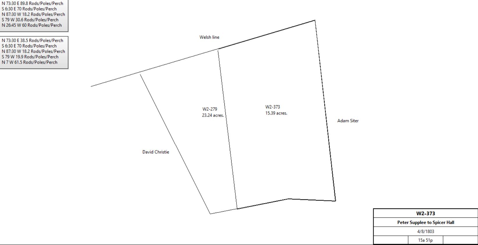
15a 51p, part of 23a 51p |
£255 6s 3d |
W2-373 (see also W2-375); see deed plan |
|
Peter & Hannah Supplee |
John Zook |
4/5/1803 |
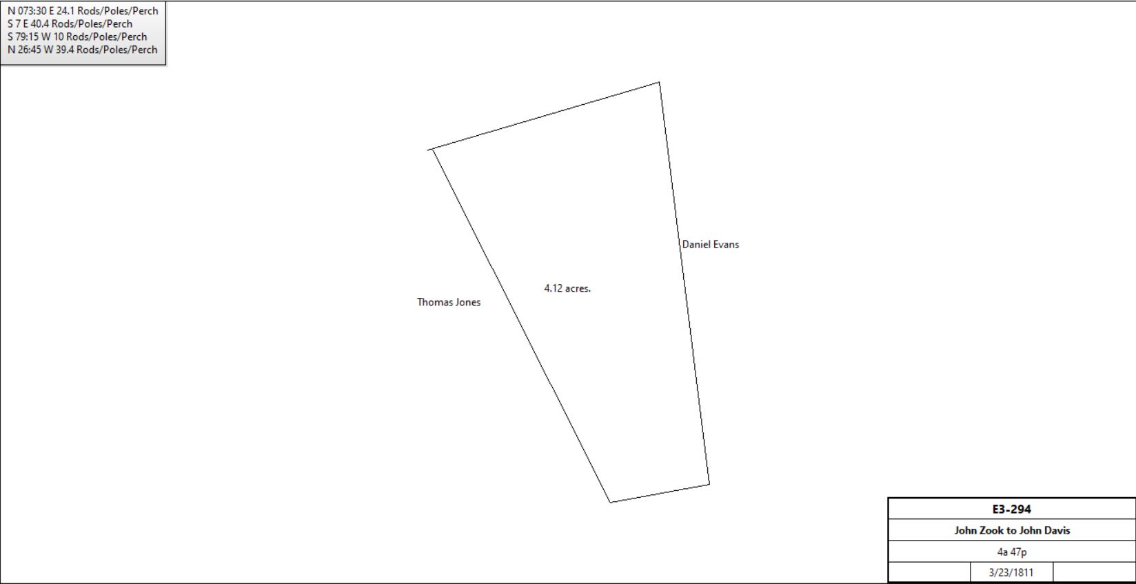
4a 47p |
|
X2-267 |
John Zook |
John Davis |
3/23/1811 |
4a 47p |
£91 10s |
E3-294; see deed plan |
|
Spicer & Elizabeth Hall |
Daniel Evans |
4/5/1810 |
15a 51p |
$925 |
E3-63 |
Anne & Levi Evans, administrators of the estate of Daniel Evans |
John Thomas |
4/1/1815 |
15a 51p |
$1,306 68c |
L3-429 |
John Thomas |
John Campbell |
1/20/1818 |
15a 51p |
$1,463 49c |
N3-418 |
Samuel & Jane Campbell, Thomas & John Campbell, heirs of the estate of John Campbell |
Joseph McClure |
3/25/1857 |
15a 51p + 3.5a |
$975 |
R6-544 |
J. McClure |
|
1883 |
area not given |
|
Breou’s Atlas |
Joseph & Mary McClure |
Susan Evanson |
7/25/1883 |
4a 34p |
$737 18c |
O9-376; see Table D.6 |
Estate of Joseph McClure |
|
1897 |
15a 51p + 3.8a + 4.97a |
|
Atlas |
|
|
Table D.2
|
From |
To |
Date |
Area |
Cost |
Reference |
|
|
|
|
|
|
John Campbell excrs. |
Joseph McClure |
3/25/1857 |
|
|
3 fifths parts X6-544 |
John Campbell excrs. |
Joseph McClure |
4/20/1857 |
|
|
2 fifths parts R6-542 |
Joseph McClure & wife |
George W. Bean |
6/2/1881 |
1a 25p |
$231 25c |
H9-589 |
|
|
H9-589 Beginning at a stone in the Welsh or Bilton line and at a course of the aforesaid George W. Bean’s land, thence along said G.W. Bean’s land S6ºE 13.65 perches to a stone, said course being intended to conform to the general line dividing the McClure tract from woodland adjoining. Thence along other land of said Joseph McClure S77.25ºW 13.65 perches to a stone, said line intended to be parallel with the Bilton line. Thence again along other land of the said Joseph McClure N6ºW 13.65 perches to a stone in the aforesaid Bilton line, and said line last measured is intended to be parallel with the line first measured. Thence along said Welsh or Bilton line N77.25ºW 13.65 perches to the place of beginning.
|
|
Table D.3
|
From |
To |
Date |
Area |
Cost |
Reference |
|
|
|
|
|
|
John Beaver excrs. |
John Groff |
4/4/1867 |
|
|
P7-448 |
John Groff & Susanna, his wife |
George W. Bean |
4/4/1881 |
7a 32 perches |
$200 |
H9-434 |
|
|
H9-434 Beginning said chestnut oak tree thence by land of Joseph McClure N4ºW 69.5 perches to a stake in Bilton or Welsh line, thence along said line N76.25ºE 11.55 perches to a stake, thence by land of David R. Clemens S13º 18’E 66.9 perches to a stake, thence by land of Thomas(?) Brown S72º 15’W 22.85 perches to the place of beginning.
|
Table D.4
|
From |
To |
Date |
Area |
Cost |
Reference |
|
|
|
|
|
|
Joseph Batt |
H. & B.F. Bean |
1866 |
7a 52p |
$950 |
T7-303 |
|
|
T7-303 Beginning at a limestone set for a corner of land about to be conveyed to Francis J.N. Bloomhart and in a line of land of Isaac Detwiler, thence by said line N22.75ºW 46.6 perches to a limestone a corner of Joseph Batts sprout lot and near a ledge of rocks on top of the hill, thence by same lot N75.75ºE 27 perches to a limestone in line of C.H. Garden, thence by same S22.5ºE 46.6 perches to a limestone in another corner of Francis J.N. Bloomhart, thence by same S75.75ºW 26.8 perches to the place of beginning.
|
|
Table D.5
|
From |
To |
Date |
Area |
Cost |
Reference |
|
|
|
|
|
|
Major McVeigh & Margaret, his wife |
Nicholas Bean |
12/8/1853 |
8a Sch. woodlot |
$303 |
U5-312 |
Execs. of Nicholas Bean |
Alfred U. Bean |
12/23/1878 |
a) 8a Sch. b) 4a 66p |
|
F9-205 a) woodlot b) bounded by Bilton line and Diamond Rock Road |
Execs. of Nicholas Bean |
Alfred U. Bean |
12/23/1878 |
5a 115p woodlot & sandstone quarry |
|
F9-205 Part of B6-87 |
Alfred U. Bean & Sadie, his wife |
Albert Klaus |
3/31/1880 |
5a 115p woodlot & sandstone quarry |
$200 |
G9-247 |
Albert Klaus & Mollie, his wife |
Sadie Bean |
8/6/1880 |
5a 115p woodlot & sandstone quarry |
$200 |
F10-107 |
Alfred U. Bean & Sadie, his wife |
Mary Jane Bean |
9/3/1899 |
a) 4a 66p b) 4a 27p c) 3a Sch.
d) 5a 115p stone quarry |
$850 |
O10-292 |
See A12-22 for sale |
|
|
|
|
|
|
|
Table D.6
|
From |
To |
Date |
Area |
Cost |
Reference |
|
|
|
|
|
|
Joseph & Mary McClure |
Susan Eavenson |
7/25/1883 |
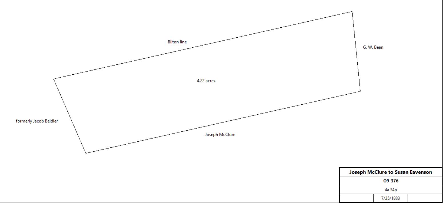
4a 34p |
$737 18c |
O9-376 |
|
Alben Eavenson, exectuor fo the will of Susan Eavenson |
Martha Jane Bean |
3/24/1893 |
4a 34p |
$800 |
B11-479 |
R. Thomas Garrett, sheriff, debt of Martha Jane Bean |
G. W. Bean |
12/20/1906 |
4a 34p |
$1 |
D13-51 |
|
