Table AU.1 |
From |
To |
Date |
Area |
Cost |
Reference |
|
|
|
|
|
|
James Davis |
William Currie |
1/25/1762 |
80a |
£150 |
O-547 see table E.1.1 Other portions sold to John Duffield & Benjamin Davis |
James Davis |
|
1765 |
420a |
|
Tax; 80a woodland |
James Davis |
|
1767 |
150a |
|
Tax; fulling mill |
William Currie |
John Bieber (Beaver) |
4/15/1767 |
200a & 80a & 16¼ |
£1600 |
O-550; see also table E.1.1 |
James Davis |
James Hamilton |
5/23/1771 |
352a + 167a |
|
R-348 mortgage (also see table AO) |
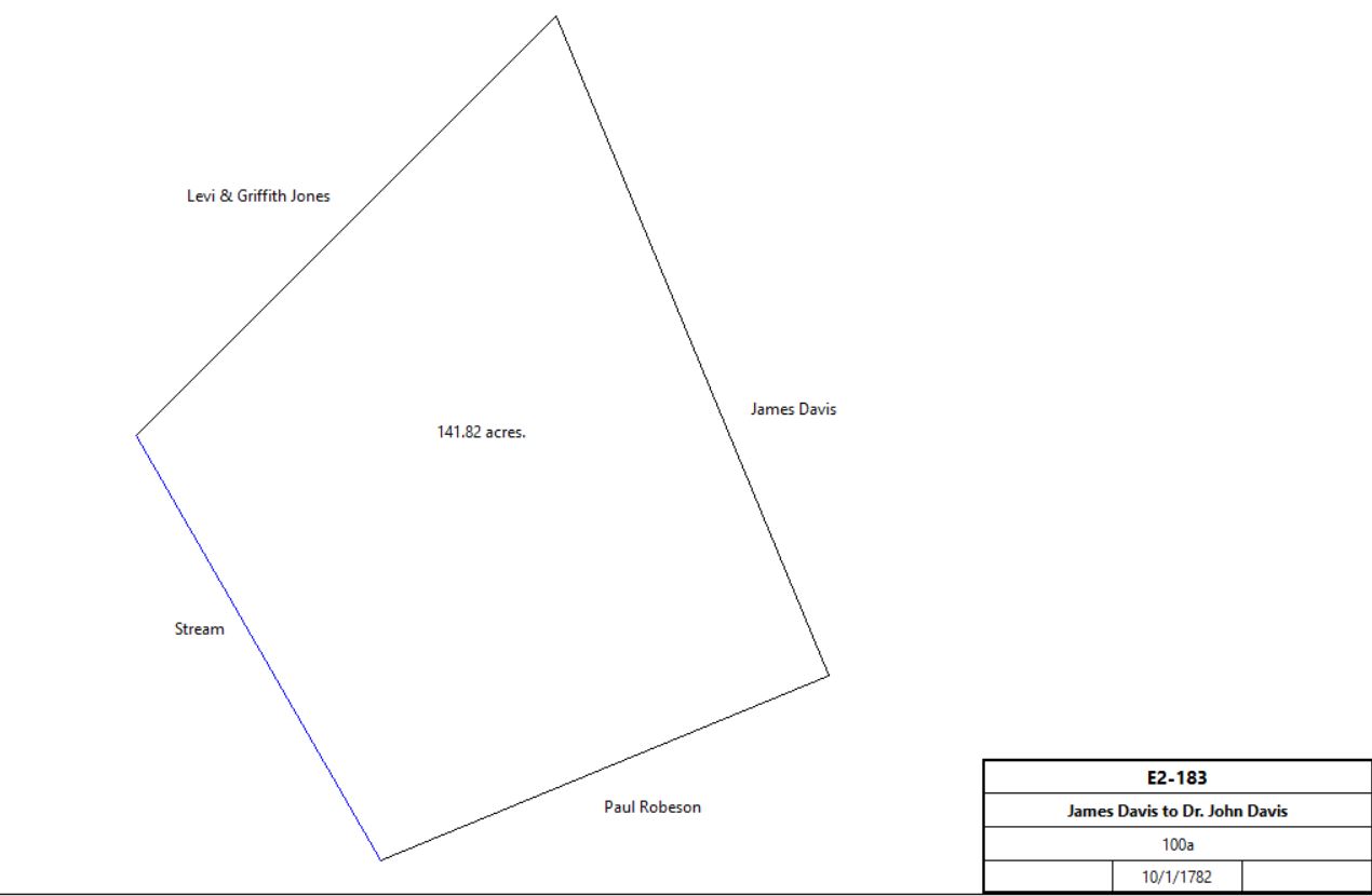
James & Mary Davis |
Dr. John Davis |
10/1/1782 |
100a |
£550 |
E2-183 |

|
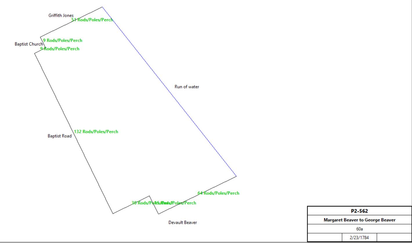
Margaret Beaver |
George Beaver |
2/23/1784 |
60a |
£5 |
P2-562 |

|
George Beaver |
|
1798 |
89a |
|
Glass tax; see table E.1.1 for remainder of land |
Devault Beaver |
|
1798 |
50a hill land |
|
Glass tax; see table S.1.5 |
Dr. John Davis |
|
1798 |
123a |
|
Glass tax; Log Cabin 26’ x 17’; stone barn 60’ x 32’ ; stone wagon house 37’ x 17’ |
Dr. John Davis |
|
1816 |
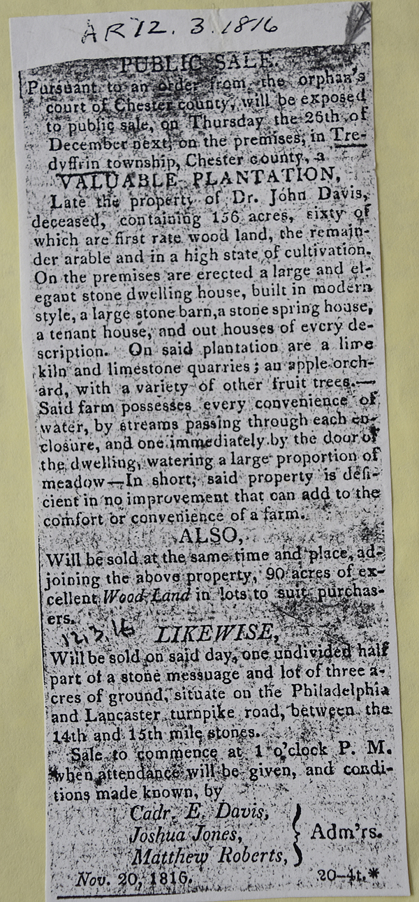
#1: 156½a & mansion house; #2: 162¾a; #3: 57½ woodland; #4: 32¼a woodland;#5: ½ part of lot N of turnpike.
|
|
Died, intestate.
See table AO for history of tracts #2, 3, and 4 |

American Republican 1816-12-03 (See Newspaper clipping in Document database for commentary |
Cadwallader E. Davis, Joshua Jones, Matthew Arnold, admins. of estate of Dr. John Davis |
Enoch & Elijah Davis |
4/1/1817 |
156½a & 8a 36p (tract #11, see table OA.4) |
$17,253 87c |
O3-277; original tract resurveyed and found to be 200, rather than 100 acres. |
Sheriff (Cromwell Pearce), debt of Enoch & Elijah Jones |
Joshua Jones & Joshua Evans |
10/18/1819 |
156½a + ⅔ 7a 122p + ¼ 162a |
$10,415 17c |
Sheriff's Deed 2-160 |
Joshua Jones & Joshua Evans |
Dr. William & Matilda Harris |
5/1/1820 |
155½a |
$9,322 |
R3-293 |
William Harris |
|
11/19/1833 |
156½a |
|
Ad in American Republican |
Dr. William & Matilda Harris |
Isaac & Mary Ann Richards |
4/3/1834 |
77a |
$6,103 |
I4-297; Greenwood Farm |
Isaac Richards |
|
|
|
|
dies |
Heirs of Isaac Richards |
Mary Ann Richards (widow) |
5/2/1860 |
77a 3p |
$7,122 |
P6-106 |
Mary Ann Richards |
William C. & Mary Eliason |
2/17/1864 |
77a |
$5,692 |
Y6-151 |
William C. & Mary Eliason |
Benjamin Shank |
3/28/1870 |
77a 3p |
$,9420 |
W7-140 |
Benjamin & Annie Shank |
George Hoopes |
1/29/1874 |
77a 35p |
$9,725 54c |
Assignment for creditors, Miscellaneous deed book #15-319 |
Benjamin Shank |
J.G. Richard Hecksher |
5/18/1874 |
79a |
$16,000 |
N8-183, including mansion house |
George Hoopes, assignee |
J.G. Richard Hecksher |
4/1/1875 |
79a |
$16,000 |
P8-435 |
Richard Hecksher |
August Hecksher |
6/10/1881 |
79a 113p + 77a 35p |
$30,000 |
J9-262 |
August Hecksher |
Lucrecia L. Hecksher, wife of Richard Hecksher, coal miner |
10/10/1881 |
79a 113p + 77a 35p |
$30,000 |
J9-263 |
Richard Hecksher |
|
1883 |
156a 3r 38p |
|
Breou’s farm atlas; West Valley Road |
Matthias Walker |
|
1883 |
111a |
|
Breou’s farm atlas; between Swedesford & Walker Roads |
George H. Beaver |
|
1883 |
117a |
|
Breou’s farm atlas; east of Valley Forge Road |
J.G. Richard & Lucretia L.Hecksher |
Lucretia Stevens Hecksher (daughter) |
5/20/1885 |
79a 113p + 77a 35p |
$1 |
W9-267 |
Lucretia Stevens Hecksher |
Lucretia L.Hecksher |
4/12/1886 |
79a 113p + 77a 35p |
$1 |
C10-201 |
Estate of Lucretia L.Hecksher |
Radcliffe Morris Urquart |
1/17/1942 |
4.05a |
$1,000 |
D21-5 |
Estate of Radcliffe Morris Urquart |
William Chanoff, Donald S. Cohan, and Richard J. Fox, trading as Greenwood Realty Company |
4 or 5/1/1969 |
54.304a |
$575,000 |
T38-1020 |
Estate of Radcliffe Morris Urquart |
F.C. & C. Inc |
5/9/1969 |
31.378a |
$268,000 |
T38-1030 |
William Chanoff, Donald S. Cohan, and Richard J. Fox, trading as Greenwood Realty Company |
F.C. & C. Inc |
8/26/1971 |
3.323a |
$124,000 |
D40-908 |
F.C. & C. Inc |
Carol & John Giegerich |
11/3/1971 |
lot #38 |
$75,000 |
G40-251; parts of T38-1030 and D40-908. |
|
|
|
|
|
|
Eva G. Beaver |
Ida E. Beaver |
1906 |
60a (P2-562 above) + 30a (P2-559, Table E) + 34a (G3-221, Table N) |
$6,700 |
Y12-126; 3 continguous tracts |

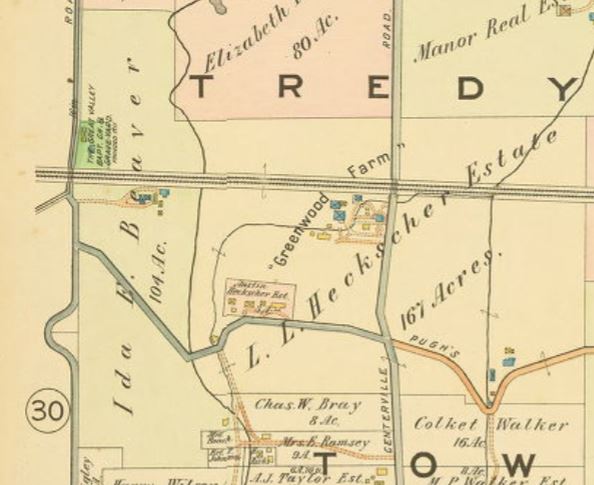
Extract from 1913 atlas
|
Eva Grace Blackwood (nee Beaver), trustee of the estate of Ida Emily Beaver |
J. James Cancelmo |
6/9/1926 |
21.575a + 56.751a |
$40,000 |
B17-60 |
J. James & Mary A. Cancelmo, James T. J. Mellon, Horace & Estelle Roebuck |
Philadelphia Electric Power Company |
12/5/1928 |
21.575a |
$33,500 |
X17-299 |
|
|
|
|
|
B32-551 |
